‘Henry’ intensifies as it exits PAR; monsoon rain to persist
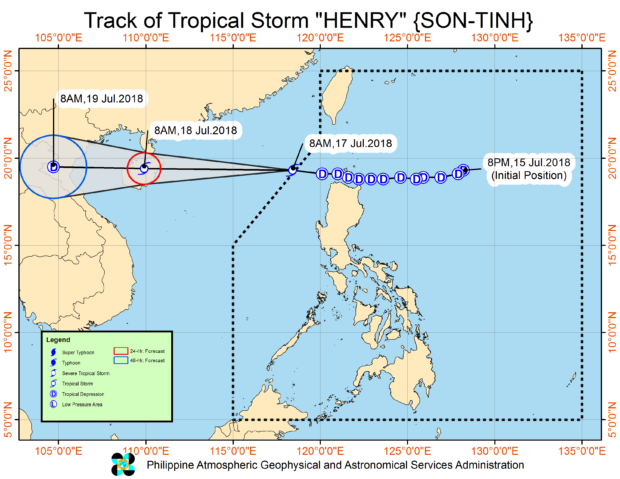
‘Henry’ intensified into a tropical storm midday Tuesday after it left the Philippine area of responsibility (PAR), the weather bureau said.
Storm signals have been lifted but monsoon rain will continue to affect Luzon and parts of the Visayas, the Philippine Atmospheric, Geophysical and Astronomical Services Administration (Pagasa) said.
At 10 a.m., Henry was spotted 415 kilometers west of Calayan, Cagayan. It was still moving west at 45 kilometers per hour (kph).
It had maximum sustained winds of 65 kph and gustiness of 80 kph, stronger by 5 kph from the last bulletin at 8 a.m. Tuesday.
According to Pagasa’s tracking, Henry exited the PAR at about 8 a.m.. However, the monsoon will continue to dump rain over Metro Manila, Zambales, Bataan, Cavite, Batangas, Mindoro provinces, Palawan, and Western Visayas, Pagasa said.
Scattered rain and thunderstorms are forecast over the rest of the country.
Meanwhile, a low pressure area (LPA) being tracked by Pagasa may intensify into a tropical depression in the next 36 hours.
The LPA was last spotted 915 kilometers east of Aparri, Cagayan. /cbb
