Pagasa sees stronger habagat as typhoon nears

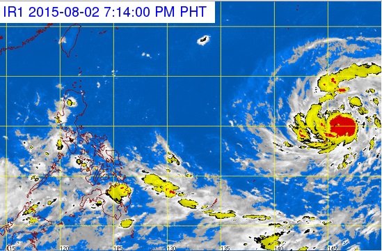
Typhoon ‘Soudelor’ can be seen at the right as it nears the Philippine area of responsibility. The Pagasa expects the southwest monsoon (habagat) to intensify as Soudelor gets closer to the Philippines. PAGASA WEBSITE SCREENGRAB
The weather bureau is tracking a typhoon that might enter the Philippine area of responsibility (PAR) by Thursday and intensify the southwest monsoon or habagat.
Typhoon “Soudelor” was last observed 2,335 east of Casiguran, Aurora, said Loretin dela Cruz, weather observer from the Philippine Atmospheric, Geophysical and Astronomical Services Administration (Pagasa) said.
The typhoon is forecast to cross into the PAR but is not expected to make landfall because of the possibility of it changing course.
Dela Cruz noted that Soudelor could intensify the southwest monsoon and bring more rain to the country.
Soudelor will be locally named “Hanna” when it enters PAR.
Article continues after this advertisementMeanwhile, Palawan, and parts of the Visayas and Mindanao are forecast to have cloudy skies and light to moderate rain Monday due to the intertropical convergence zone. Pagasa advised people to expect isolated thunderstorms.
Article continues after this advertisementIn Metro Manila and the rest of the country, partly cloudy to cloudy skies with isolated thunderstorms will prevail.
Light to moderate winds blowing from the southwest and going southeast will prevail over Luzon. At the same time, winds coming from the southwest will sweep the rest of the country.
The coastal waters throughout the archipelago will be slight to moderate.