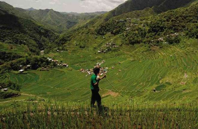
Groups map trails to link Cordi communities

FOR AGES, villagers in Ifugao province have traded or visited neighboring communities by walking through trails, some of which cross through Ifugao’s rice terraces. A group has started mapping the Cordillera trail system that links all provinces in the mountain region. EV ESPIRITU/INQUIRER NORTHERN LUZON
BAGUIO CITY—Instead of building more roads that may damage forests, a group of environmentalists and outdoor enthusiasts has started mapping the natural and indigenous trail system that connects the provinces of the Cordillera region.
A natural trail system, including footpaths used by villagers to trade goods, keeps the inter-village economies alive, but drawing up a trail system will draw international trekkers to these areas and improve ecotourism, said Joseph Paul Alipio, a member of the Cordillera Great Traverse team.
Athlete Jonnifer Lacanlale gathered a group of outdoor enthusiasts and athletes to look for the trails linking the provinces of Benguet, Mountain Province, Ifugao, Kalinga, Apayao and Abra.
The team expects to document a system of pathways that forms a 440-kilometer chain of trails that will be safe for visitors who may want to hike through these provinces, Lacanlale said.
He said there was no established trail system in the country, unlike trails in Africa and Europe that attracted visitors.
In 2005, Alipio, also executive director of Cordillera Conservation Trust (CCT), and a group of trekkers started a project that documented trails in the Cordillera.
The CCT members traveled to interior communities in the region to teach residents, especially students, to develop tree nurseries. They hiked through trails in different Cordillera provinces, believing these could be tapped for sustainable development and environmental conservation.
The project, called the Cordillera Traverse program, noted that the interior towns, where most of the remaining trails are located, were also where poverty was most felt.
These are trails rarely visited by tourists, who prefer destinations like Sagada town in Mountain Province.
Alipio said: “In these interior mountain villages, trails are the essential routes of trade and communication and are used by local villagers for the most part to travel from one village to another—traveling to farms or getting to areas that are accessible to modern transportation for travel to urban centers to sell their produce or crafts.”
He said trail development “would enable the influx of funds from trekkers to support local economies and give local villagers the incentive to maintain the mountain forests.”
He said money from trekkers was “added revenue to the local resource users that will support the local economy and prevent increased economic pressure on local resources.”
Unlike roads, trails add value to the scenery for tourists, he said.
These trails are common in Benguet, Mountain Province and Ifugao, where communities are in forest areas.
The more daunting task, Alipio said, is tracking down footpaths used in Kalinga and Apayao, where communities were developed near rivers. Vincent Cabreza, Inquirer Northern Luzon


