Project Noah launches interactive map that identifies disaster-prone areas
Project NOAH. Nationwide Operational Assessment of Hazards. noah.dost.gov.ph/
The Nationwide Operational Assessment of Hazards (Project Noah) has launched a new interactive map that is capable of tagging locations where earthquakes had happened and even shows all the history of tremors recorded in the country since the early 20th century.
The map, which went live online Friday, shows all earthquake locations from 1910 to September 2017 with magnitude greater than 3.
The data was based on the records by the United States Geological Survey (USGS).
The earthquake data are classified into seven: blue for less than 34 kilometers deep; green for less than 70; yellow for less than 150; orange for less than 300; pink for less than 500; and red for less than 700.
The map can be accessed at: https://noah.dost.gov.ph/#/section/earthquake/all_eq
Article continues after this advertisementProject NOAH is the country’s flagship disaster and risk reduction program that aims to increase awareness of disaster risk among Filipinos.
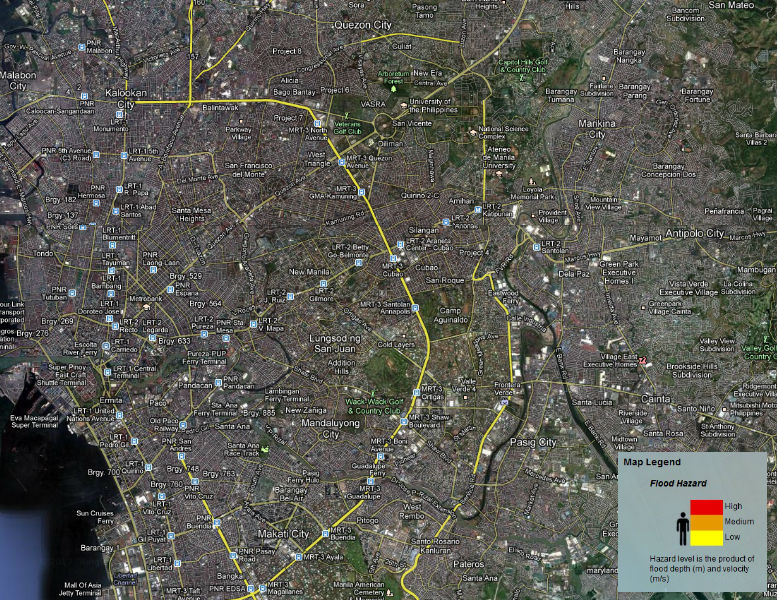
Article continues after this advertisementThe online map also tags locations regarding incidents of floods, flood-prone areas, as well as active, inactive and potentially active volcanoes. /jpv
RELATED STORY
Local leaders learn to act early during disasters through DOST info drive