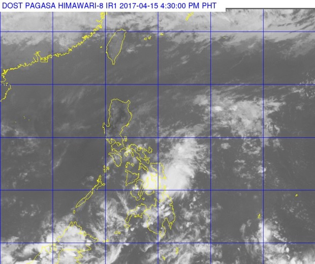
Slower ‘Crising’ nears landfall in Eastern Samar
(Updated, 5:44 p.m.) Tropical depression “Crising” is about to make landfall over Hernani, Eastern Samar, the state weather bureau said on Black Saturday.
Crising has maintained maximum sustained winds of up to 45 kilometers per hour (kph) near the center, its gustiness has gone up from 55 kph to 62 kph. It was moving at a pace of 17 kph west-northwest, The Philippine Atmospheric, Geophysical and Astronomical Services Administration (Pagasa) announced in its 5:00 p.m. weather bulletin.
Pagasa added that the eye or center of “Crising” was now closer at 50 kilometers east southeast of Borongan City, Eastern Samar from the earlier 130 km, based on all available data.
The estimated rainfall amount within the 150km diameter of the tropical depression is from moderate to occasionally heavy.
Fewer areas are now under Signal No. 1, namely Northern Cebu, Northern Samar, Eastern Samar, Samar, Biliran and Leyte.
Article continues after this advertisementThe weather disturbance was forecast to weaken into a low pressure area within the next three to six hours, and was expected to bring heavy rains only in areas in Visayas where it will pass through.
Article continues after this advertisementPagasa weather forecaster Aldczar Aurelio warned residents under storm signal No. 1 to be alert against possible flashfloods and landslides, and moderate to rough seas. Automatically, small vessels cannot go out to sea in areas with storm signals.
Light to moderate rains and isolated thunderstorms are still expected over Caraga, Calabarzon, Bicol, and the rest of Visayas.
Metro Manila will no longer feel the effects of “Crising,” and will experience hot weather due to the ridge of a high pressure area, Aurelio said. IDL
RELATED STORIES
‘Crising’ maintains strength, threatens Samar on Black Saturday
TD ‘Crising’ weakens; 17 areas under Signal No. 1
RELATED STORIES
‘Crising’ maintains strength, threatens Samar on Black Saturday
