‘Crising’ maintains strength, threatens Samar on Black Saturday
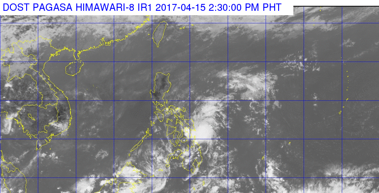
Satellite image from Pagasa
Tropical depression “Crising” has maintained its course and continues to threaten Samar, the state weather bureau said on Black Saturday.
In its 2:00 p.m. weather bulletin, The Philippine Atmospheric, Geophysical and Astronomical Services Administration (Pagasa) said that Crising has maintained maximum sustained winds of up to 45 kilometers per hour (kph) near the center and gustiness of up to 55 kph. Its pace of 20 kph going west northwest was also still the same.
Pagasa added that the eye or center of “Crising” was now spotted 130 kilometers east of Guiuan, Eastern Samar from earlier 155 km, based on all available data.
In its new bulletin, Pagasa said that it is expected to make landfall over Samar island between 3:00 p.m. and 5:00 p.m. this afternoon, and overturned its earlier announcement that Crising may further weaken into a low pressure area (LPA).
READ: TD ‘Crising’ weakens; 17 areas under Signal No. 1
Article continues after this advertisementPagasa said Signal Number 1 is up in Sorsogon, Burias island, Romblon, Masbate including Ticao island, Aklan, Antique, Iloilo, Capiz, Northern Cebu, Northern Negros Occidental, Northern Samar, Eastern Samar, Samar, Biliran, Leyte and Southern Leyte.
Article continues after this advertisementRains and gusty winds will persist until Tuesday, April 18 in Visayas. Metro Manila may also experience occasional rains.
The next weather bulletin will be issued 5:00 p.m. today. IDL