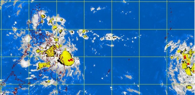
2 cyclones may be developing off Mindanao
MANILA, Philippines—Weather forecasters are keeping watch over two low pressure areas (LPA) closing in on Mindanao and threatening to develop into tropical cyclones.
Philippine Atmospheric, Geophysical and Astronomical Services Administration (Pagasa) forecasters said the LPA nearer the country was expected to move westward, passing through Mindanao while the other one was still too far away southeast of Mindanao and well outside the Philippine area of responsibility (PAR).
Forecaster Buddy Javier told the Inquirer the first LPA, which was estimated at 4 p.m. Sunday to be 430 kilometers east of Mindanao, was embedded in the intertropical convergence zone (ITCZ) and could bring rains to portions of the Visayas and Mindanao on Monday.
Javier said that if the LPA developed into a tropical cyclone, it would be named “Wilma.”
“That is why we are closely monitoring it as it could become a tropical cyclone in 24 hours. There is a 50-50 chance of that,” he said.
Article continues after this advertisementThe other LPA, which is hovering over the Pacific Ocean southeast of the country looks like it will intensify into a tropical depression before it enters the PAR, Javier said.
In its forecast for Monday, Pagasa said it expects Mindanao as well as Central and Eastern Visayas to have cloudy skies with light to moderate rainshowers and thunderstorms, while Metro Manila and the rest of the country will be partly cloudy to cloudy with isolated rainshowers or thunderstorms.—Jeannette I. Andrade
