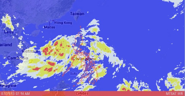
Jolina to exit by Wednesday evening–Pagasa
MANILA, Philippines — Tropical depression “Jolina” will make its way out of the Philippines by this Wednesday afternoon or evening although it may still intensify into a storm, a forecaster for the Philippine Atmospheric Geophysical and Astronomical Services Administration said.
Before Jolina became a tropical depression, it was a low pressure area on its way out of the Philippine area of responsibility, Aldczar Aurelio told INQUIRER.net.
Jolina was last observed 390 kilometers west of Subic, zambales with maximum sustained winds of 55 kilometers per hour near the center. It is moving northwest at 11 kph.
“Mimaropa and Calabarzon will experience cloudy skies with moderate to occasionally heavy rainshowers and thunderstorms which may trigger flashfloods and landslides. Metro Manila and the rest of the country will have cloudy skies with light to moderate rainshowers and thunderstorms,” Pagasa said in its bulletin.
Moderate to strong winds blowing from the Southwest will prevail over Palawan and its coastal waters will be moderate to rough. Elsewhere, winds will be moderate to occasionally strong coming from the southwest to southeast with moderate to occasionally rough seas, it added.
Article continues after this advertisementRELATED STORY:
Tropical depression ‘Jolina’ brewing
