Pepito weakens into severe storm; Signal No. 1 up in N. Luzon areas

Image from the Philippine Atmospheric, Geophysical, and Astronomical Services Administration
MANILA, Philippines — Pepito (international name: Man-yi) weakened into a severe tropical storm on Monday, according to the Philippine Atmospheric, Geophysical and Astronomical Services Administration (Pagasa).
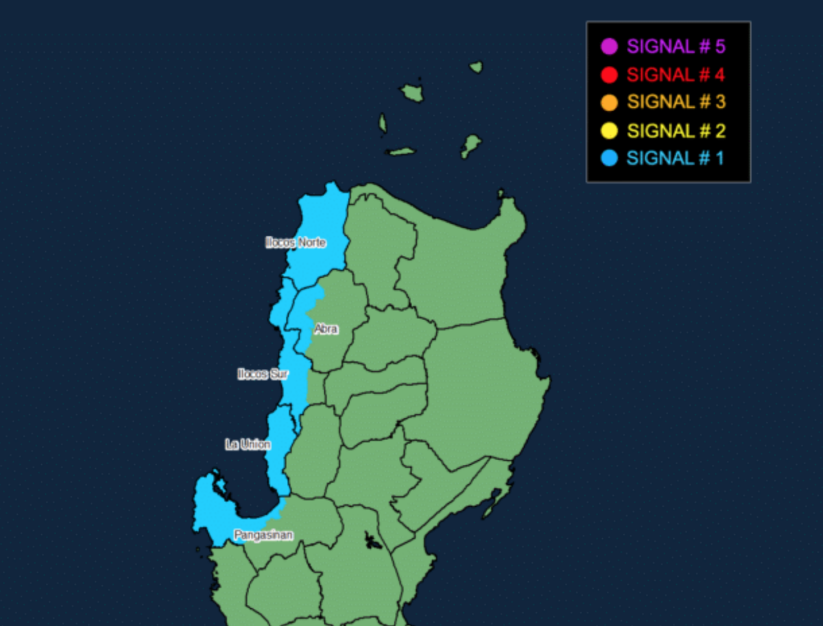
In its 11 a.m. bulletin, Pagasa said Tropical Cyclone Wind Signal (TCWS) No. 1 is the highest wind signal currently in effect as Pepito moves away from the country.
The following areas were placed under TCWS No. 1, where strong winds ranging from 39 to 61 kilometers per hour (kph) may be experienced:
- Ilocos Norte
- Ilocos Sur
- La Union
- Western portion of Pangasinan (Burgos, Dasol, Sual, Mabini, Binmaley, San Fabian, Dagupan City, Lingayen, Labrador, City of Alaminos, Bolinao, Anda, Bani, Agno, Infanta, Bugallon, Mangaldan)
- Western portion of Abra (Danglas, Bangued, Langiden, La Paz, Pidigan, San Quintin, San Isidro, Pilar, Peñarubia, Villaviciosa, Lagayan)
The state weather bureau also said minimal to minor impacts from strong winds are possible in areas under TCWS No. 1.
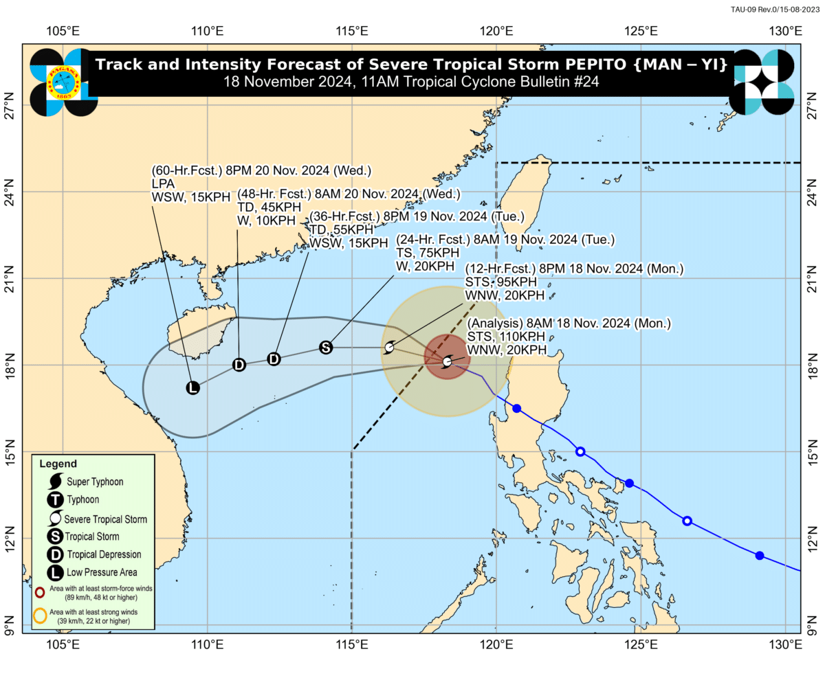
Pepito was last spotted 270 kilometers west of Batac, Ilocos Norte, moving west-northwestward at 20 kph. It was carrying maximum sustained winds of 110 kph near its center, with gusts of up to 135 kph.
Article continues after this advertisementIt marks a decrease from its earlier recorded maximum sustained winds of 130 kph and gustiness of 160 kph, as reported in the 5 a.m. bulletin by the state weather bureau.
Article continues after this advertisementREAD: Wind signals still up in some parts of Luzon as Pepito leaves PAR

Image from the Philippine Atmospheric, Geophysical, and Astronomical Services Administration
Based on Pagasa’s latest forecast track, Pepito will continue moving west-northwestward over the West Philippine Sea until it exits the Philippine area of responsibility (PAR) by Monday noon or afternoon.
“Outside the PAR region, the tropical cyclone will turn more westward or west-southwestward tomorrow, November 19, under the influence of an incoming northeasterly wind surge,” the state weather bureau said in its bulletin.
As of 11 a.m., only Batanes remains under the heavy rainfall outlook, with moderate to heavy rains (50 to 100 millimeters) expected to affect the area from Monday noon to Tuesday noon.
Pagasa also raised a gale warning over the northern and western seaboards of Northern Luzon, deeming sea travel risky for all types of vessels.
READ: NDRRMC: Over 1.8 million Pinoys impacted by Pepito, 2 earlier typhoons


