Tropical storm outside PAR maintains strength
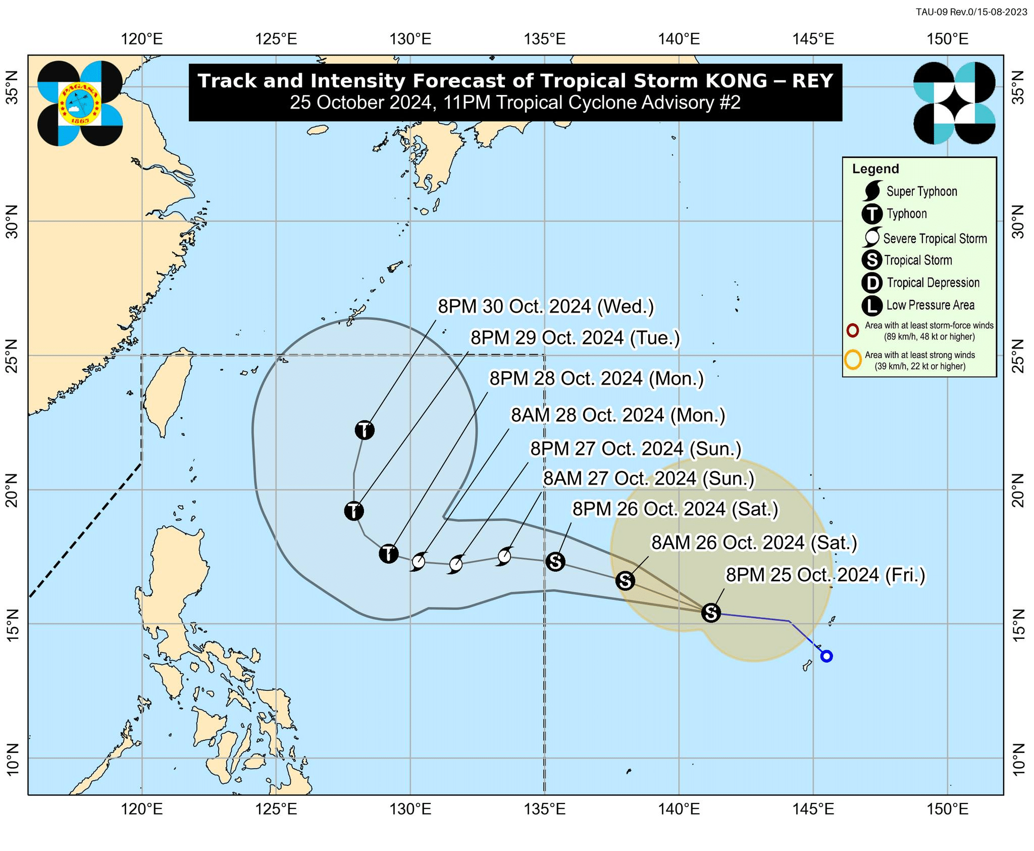 Track and intensity forecast of Tropical Storm Kong-rey issued at 11 p.m. on Friday, October 25 by the Philippine Atmospheric, Geophysical and Astronomical Services Administration (Pagasa). (Photo from Pagasa/Facebook)
MANILA, Philippines — Tropical Storm Kong-rey (domestic name: Leon) has maintained its strength outside the Philippine area of responsibility (PAR) while swirling toward the Philippine Sea on Friday, the state weather bureau said.
In its 11 p.m. bulletin, the Philippine Atmospheric, Geophysical and Astronomical Services Administration (Pagasa) said Kpng-rey was located some 1,980 kilometers (km) east of Central Luzon or 1,780 km east of Southeastern Luzon, moving west-northwestward at 25 kilometers per hour (kph).
It is packing a maximum wind speed of 65 kph and gustiness of up to 80 kph.
Article continues after this advertisementIt was also forecast to enter the PAR on Saturday evening or early Sunday morning.
Article continues after this advertisementIt is expected to decelerate on Sunday and Monday and may intensify into a severe tropical storm on Sunday, and possibly a typhoon on Monday.
Moderate to rough sea conditions may prevail over the northern and eastern seaboards of Luzon and the eastern seaboard of Visayas.
Kong-rey developed into tropical storm Friday afternoon. Meanwhile, Severe Tropical Storm Kristine has exited PAR as of 2 p.m. on Friday.