Batanes, Babuyan Islands still expect rain as Julian heads to Taiwan
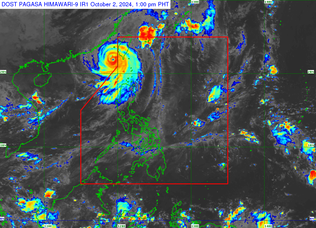
Image: DOST / Pagasa
MANILA, Philippines — Moderate to heavy rains are still expected in Batanes and Babuyan Islands on Wednesday until Thursday noon due to typhoon Julian, according to the state weather bureau on Wednesday.
According to the Philippine Atmospheric, Geophysical and Astronomical Services Administration (Pagasa), moderate to heavy rains refer to rainfall between 2.5 to 7.5 millimeters (mm) per hour.
Typhoon Julian, now located 265 kilometers (kms) west northwest of Itbayat, Batanes, has maintained its strength outside the Philippine Area of Responsibility (PAR), Pagasa reported.
It has maximum sustained winds of 165 kilometers per hour (kph) near the typhoon’s center and gusts of up to 205 kph, state meteorologists said.
“Sa ngayon kahit nasa labas po siya ng ating PAR, ay meron pa rin tayong Tropical Cyclone Wind Signal (TCWS) No. 1 dito sa may Batanes, Babuyan Islands, northern and western portions of Ilocos Norte, pati na rin sa northwestern portion of mainland Cagayan,” state weather specialist Chenel Dominguez explained.
Article continues after this advertisement(As of now, even though it is outside our PAR, we still have Tropical Cyclone Wind Signal (TCWS) No. 1 in Batanes, Babuyan Islands, the northern and western portions of Ilocos Norte, as well as the northwestern portion of mainland Cagayan.)
Article continues after this advertisementThe typhoon is currently approaching Taiwan and is expected to make landfall on Wednesday evening or Thursday morning, according to Pagasa.
“After landfall, Julian is forecast to move erratically over the landmass and coastal waters of Taiwan before emerging over the Taiwan Strait on Friday (October 4) evening or Saturday (October 5) early morning,” the state weather bureau said.
Typhoon Julian remains outside the PAR but is expected to re-enter on Wednesday afternoon or evening as it makes landfall in Taiwan, according to the state weather bureau.
“As we speak po nasa labas pa rin po siya ng PAR, possible po mamayang hapon or gabi nasa loob na ulit siya ng PAR and papunta na po siya ng Taiwan at maglalandfall,” Pagasa told INQUIRER.net in a phone call.
(As of now, it is still outside the PAR, but it is possible that by this afternoon or evening it will re-enter the PAR and head toward Taiwan where it is expected to make landfall.)
READ: Julian intensifies outside PAR, may re-enter on Wednesday – Pagasa
Pagasa hoisted a gale warning over the northern seaboard of Northern Luzon, which means sea travel remains risky for most types of vessels, including small seacrafts and motorbancas.