LPA east of Butuan City may develop into tropical depression
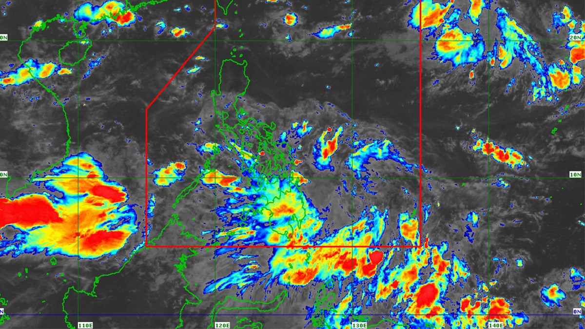
The low pressure area (LPA) that entered the Philippine area of responsibility (PAR) on Friday night (August 30, 2024) is forecast to intensify into a tropical depression within the next 24 hours. The Philippine Atmospheric, Geophysical and Astronomical Services Administration (Pagasa) said in its early Saturday morning weather report that the LPA was located 695 kilometers east of Butuan City, Agusan del Norte as of 3 a.m. Weather satellite image from Pagasa
MANILA, Philippines — The low pressure area (LPA) that entered the Philippine area of responsibility (PAR) on Friday night was forecast to intensify into a tropical depression within the next 24 hours.
The Philippine Atmospheric, Geophysical and Astronomical Services Administration (Pagasa) said in its early Saturday morning weather report that the LPA was located 695 kilometers east of Butuan City, Agusan del Norte as of 3 a.m.
If it becomes a tropical depression, it will be given the local name “Enteng” as it would be the fifth typhoon to hit the Philippines this year.
READ: Potential LPA off Mindanao to trigger weekend rain showers
“Inaasahan natin na itong LPA mataas ang tsansa na maging bagyo or tropical depression within the next 24 hours. In the event na maging bagyo ito ay bibigyan natin ng local name na Enteng,” Pagasa weather specialist Daniel James Villamil said.
Article continues after this advertisement(We expect that this LPA has a high chance of becoming a typhoon or tropical depression within the next 24 hours. If it becomes a typhoon, we will name it Enteng.)
Article continues after this advertisementHe added that from Sunday (September 1) to Monday (September 2), rain is likely prevail over portions of Visayas and Mindanao due to the combined effects of the LPA and the southwest monsoon, locally termed habagat.
On the other hand, scattered rains and thunderstorms may occur in Metro Manila, Central Luzon, Calabarzon, Mimaropa (Mindoro Occidental, Mindoro Oriental, Marinduque, Romblon, and Palawan), Bicol Region, and Western Visayas from September 3 to 4.
The southwest monsoon, meanwhile, was predicted to persist over the western parts of Southern Luzon and Visayas.
“At dahil sa pinagsamang epekto nitong LPA at habagat, asahan na makakaranas ng mataas na tsansa ng mga pagulan sa ilang bahagi ng bansa,” Villamil noted.
(Due to the combined effect of this LPA and southwest monsoon, expect to experience a high chance of rain in some parts of the country.)
READ: Pagasa forecast: 8 to 14 tropical cyclones under weak La Niña
“Asahan din natin na itong mga kaulapan at kalat-kalat na thunderstorms sa buong Mindanao sa Central at Eastern sections ng Visayas at sa area ng Palawan, habang mas maaliwalas na panahon dito sa Metro Manila at nalalabing bahagi ng bansa maliban sa tsansa ng biglaan at panandaliang buhos ng ulan dulot ng localized thunderstorms,” he added.
(We can also expect cloud clusters and scattered thunderstorms throughout Mindanao in the Central and Eastern sections of the Visayas and in the Palawan area, while the weather will be clearer here in Metro Manila and the rest of the country except for the chance of sudden and short-term rain showers caused by localized thunderstorms.)
Despite the existence of the LPA within the PAR and the dominance of the southwest monsoon, Pagasa did not raise any gale warning over any of the country’s seaboards for Saturday, according to Villamil.