Cabalantian rising
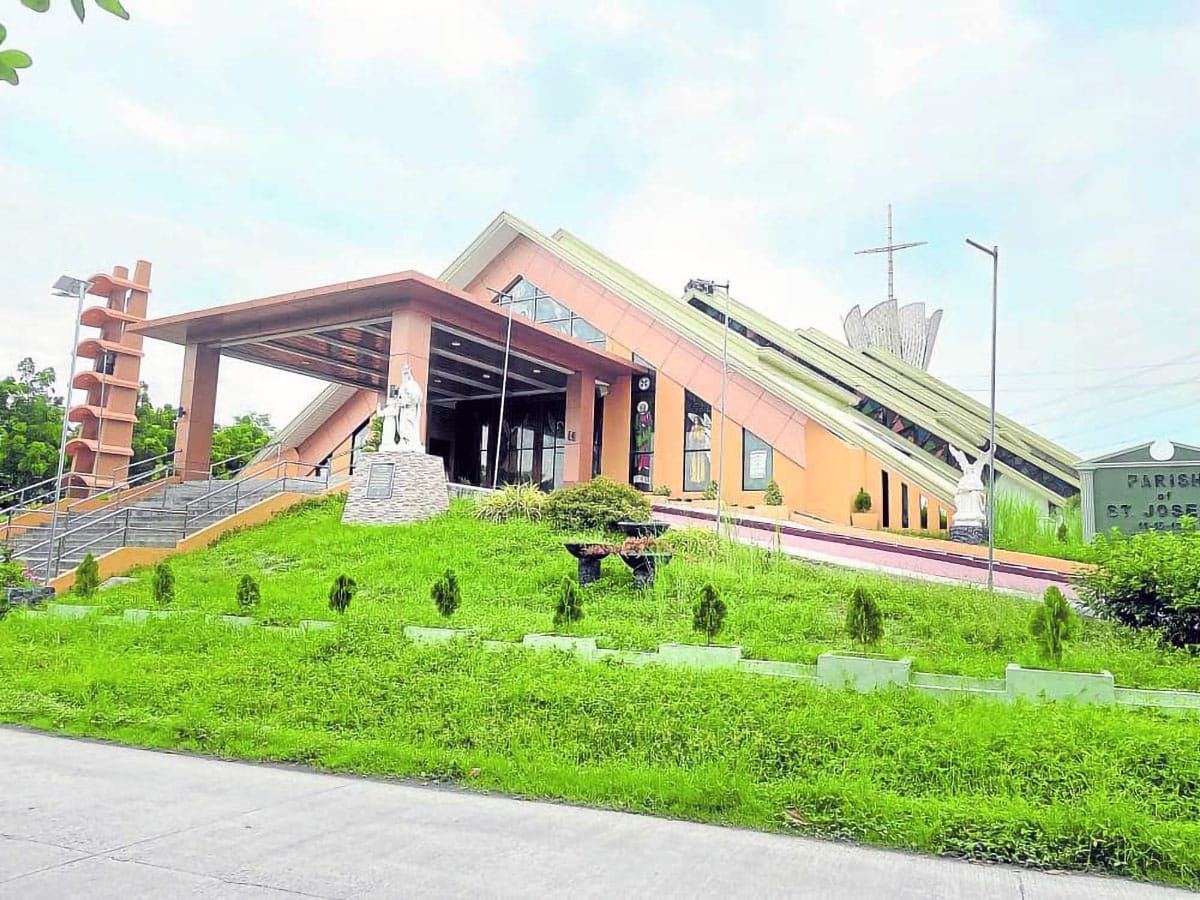
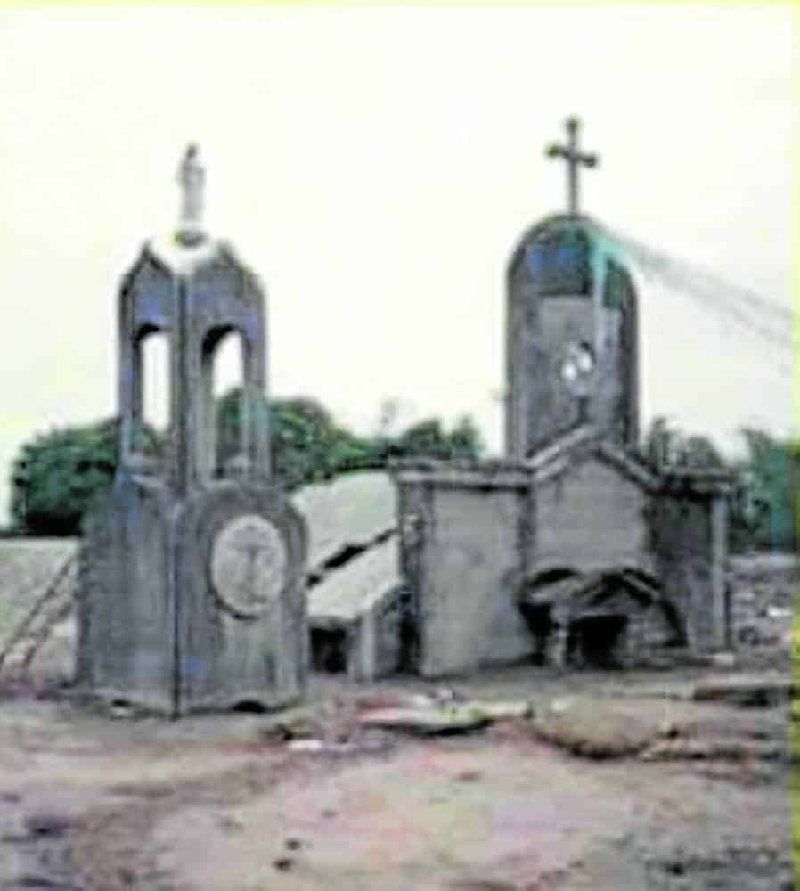
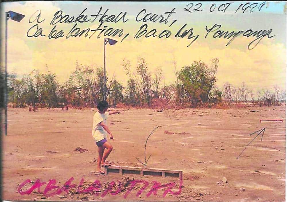
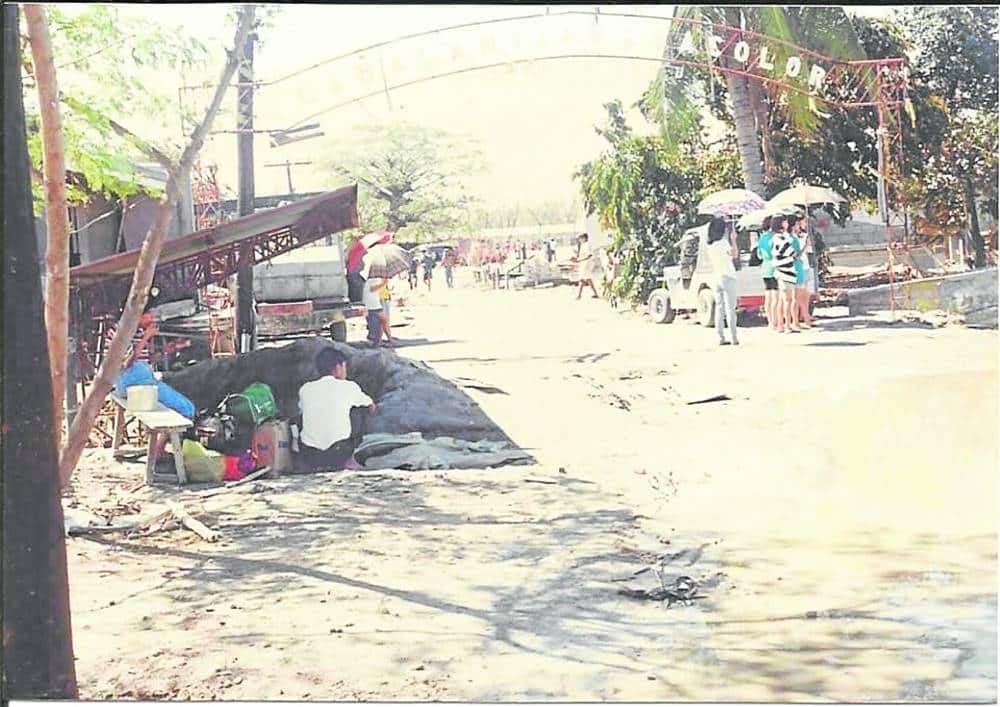
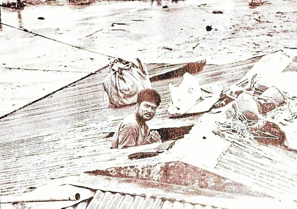
MEMORIES OF DISASTER Cabalantian residents built a big, elevated church for St. Joseph parish, taking two decades to replace the structure that was almost buried by lahar that rampaged through the village in Bacolor, Pampanga, on Oct. 1, 1995. Lahar that buried Cabalantian was too high that it reached the basketball net, half of the welcome arch and tip of roofs where many residents took refuge on that day when heavy rains from Typhoon “Mameng “ remobilized the volcanic debris and old deposits that Mt. Pinatubo spewed out on its June 15, 1991, eruption. —photos by Tonette Orejas and courtesy of St. Joseph Parish and Center for Kapampangan Studies
BACOLOR, PAMPANGA, Philippines — To Raul Cunanan, the eruption of Mt. Pinatubo 33 years ago signaled only the beginning of a tragedy that unfolded in his home village of Cabalantian here.
“There was no panic, no mass evacuation. Life was back-to-normal at once. We cleared the roads of ashfall,” he told the Inquirer, referring to what he saw on that dark Saturday afternoon in Barangay Cabalantian when he was a 30-year-old council member.
“We listened to authorities and prepared for the eruption,” said Cunanan, still a village council member, of how they managed to survive the frequent tremors, the fierce winds and rains of Typhoon “Diding” (international name: Yunya) that blew the ash and the violent reawakening of a volcano located some 40 kilometers northwest of Cabalantian on June 15, 1991.
READ: Memory of Pinatubo wrath preserved in Pampanga
The lingering kind of disaster in Bacolor—the former political and cultural capital of Pampanga and British colony’s seat of power—meant struggling with lahar for seven years and being erased from the map.
Article continues after this advertisementGeologist Kelvin Rodolfo, in a report, said the eruption and first posteruption lahar covered 38 square kilometers of Bacolor in 50 million cubic meters of debris.
Lahar is defined in the 1989 Geological Society of America Penrose Conference as “a rapidly flowing mixture of rock debris and water (other than normal stream flow) from a volcano,” according to the late Norman Manuel Tuñgol in his paper, “Lahar Initiation and Sediment Yield in the Pasig-Potrero River Basin.”
Rodolfo said the lahar of 1992 and 1993 were relatively minor and did not reach the town center. Secondary explosions in those years rerouted all flows down the Pasig-Potrero River.
Defense
Tuñgol said the most destructive in Pasig-Potrero in 1994 was generated by another lake-breakout from Sept. 22 to Sept. 24 that saw 24 people killed. He said lahar reached the downstream end of the fan, flooding the Bacolor area.
Cabalantian, San Isidro and Magliman became the last villages standing in 1995.
The Gapan-San Fernando-Olongapo Road and MacArthur Highway served like dikes. Lahar snaked its way through 18 villages located beside or downstream of Pasig-Potrero. By 1997, the 5-km wide FVR Megadike enclosed 10 villages.
Cabalantian folk in six purok and one sitio experienced floods in 1993 and opposed the construction of a transverse dike in Zone 2. To them, this brought the danger closer.
“We took turns standing guard. Fr. Mark Manabat announced our sandbagging schedules on Gugu Creek. The people gave food, vehicles and labor to the sandbagging,” he shared.
Bernard Miranda, a former village chief, said they turned down offers to move the residents to Nueva Ecija province, finding that to be far.
Cunanan said the villagers developed warning signals. The fast tolling of church bells meant evacuating to higher grounds. Local leaders used two-way radios linked to the lahar watch point Delta 5 and sent teams to inform the people.
When Typhoon “Mameng” (Sybil) routed from Mindanao to Central Luzon, then Mayor Ananias Canlas Jr. ordered villagers to leave on Sept. 30. “Some left, some stayed,” Canlas, then 30, remembered.
The population dropped from 11,136 in 1990 to 3,991 in September 1995.
Residents’ love for their hometown, the need to guard their properties and having no resources to go elsewhere were cited for the refusal to leave, Miranda said.
Per his account of what happened in Zone 3, four feet of warm water rose between 4 a.m. and 5 a.m. on Oct. 1. Lahar came swirling at past 7 a.m.
“Between 10 a.m. and 11 a.m., the worst, the big one came. It was as tall as 17 to 20 feet because it reached the tip of the roof of two-story houses or close to the top of electric poles,” recalled Cunanan.
They said the time, height and thickness or thinness of floods and lahar varied because these flowed in circles.
Tuñgol said Typhoon Mameng dumped 340 millimeters of rain falling within 18 hours, triggering “perhaps the most devastating lahar event in the Pasig-Potrero River.”
The Mameng lahar, he said, was the first event that “remobilized preeruption deposits on a grand scale.”
Deaths
“More than 2,300 houses were obliterated, 500 vehicles buried. We still don’t know how many hundred people died, and we may never know. Entire families or even clans of poor farming folk may have perished, leaving no one to report them missing,” said Rodolfo in an unpublished paper.
Canlas, a lawyer, initially cited 500 residents missing, injured and dead. Later, he said the list was trimmed to less than 100 missing and dead after accounting by relatives. To him, media reports citing the figure of 1,000 people buried alive were “exaggerated.”
Cunanan said the late village chief, Carlos Ventura, counted 27 fatalities including those trapped on MacArthur Highway.
He counted “probably six deaths” at Zones 1 and 4, including Ronnie Bengco who was 9 years old when he drowned in lahar. Cunanan believed a few died because the gaps in between the surges of floods and lahar, which is not hot, gave time for residents to climb roofs of tall houses.
Dr. Salve Olalia, a civic and parish leader, believed there were not more than two deaths because only two body bags were used from those she brought back.
Hundreds stayed on rooftops for up to 36 hours without food, water and sleep. Others began walking when the sun appeared the next day, holding on to power lines or telephone cables as guides until they were led to San Fernando or Guagua. Young and old people were rescued in government helicopters.
“The most tragic aspect of the Cabalantian calamity lies not in the fact that the barangay was so quickly and totally annihilated, nor in the buried hundreds of vehicles and thousands of homes, nor even in the hundreds of lost lives. The most poignant thing about Cabalantian is that its government and their leading citizens could have avoided the calamity, and indeed may even be said to have brought it upon themselves,” Rodolfo said.
Tuñgol said the last major lahar event in the Pasig-Potrero occurred on Aug. 20, 1997 during the passage of Typhoon “Ibiang,” (Winnie) which dropped 585 mm of rainfall in 26 hours.
Homecoming
The incumbent village chief, Alvin Tiongson, 48, said residents return annually on the feast of their patron St. Joseph and share meals.
Census showed that Cabalantian has not yet recovered its 1990 population of 11,136. The late businesswoman Lolita Hizon as well as mayors implemented their versions of “balik barangay” but those in resettlements preferred to stay put because of jobs and social services, he said.
As village chief, Tiongson’s scope of work is wide and demands coordination with village councils hosting his people. As of August 2020 and using the 1990 baseline, the census counted 6,216 living in Cabalantian, 2,336 living in eight resettlements in three towns and two cities, and 2,674 living elsewhere.
The reduced population raised tax shares from P2.7 million to P7.4 million this 2024, Tiongson said. The comprehensive land use plan (CLUP) listed Cabalantian as part of the commercial growth node because with 991 hectares, it is the town’s second largest barangay. For the whole of Bacolor, the CLUP said “a total of P17.7 billion was invested on infrastructure for 1991-1996 to include the P2.77-billion Pasig Potrero Outer Dike (FVR Megadike). Some P3.6 billion was released to livelihood opportunities for lahar victims.”
More than 30 families have resumed making a living out of cooking local delicacies like “mamon tostado,” “mamon sopas,” “putu seko,” greaseless peanuts, “tamales,” “suman” (“tili,” “bulagta” and “banos”).
Olalia said the new, highly elevated church, which has taken years to build, is a “testament to the faith of what God can do.”
