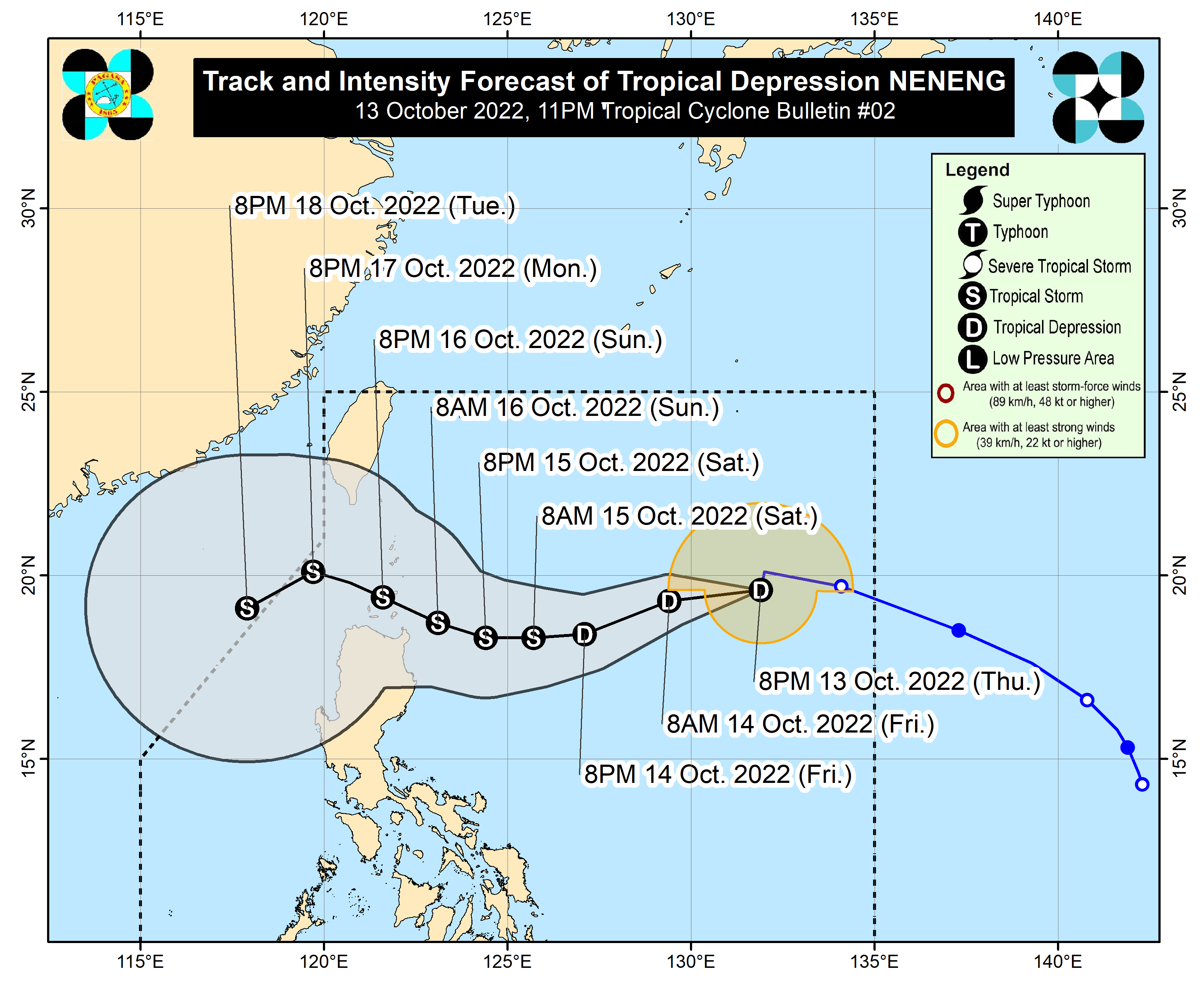
Neneng may make landfall or pass very close to Babuyan Islands, Batanes

MANILA, Philippines — Tropical Depression Neneng could make landfall or may pass very close to Babuyan Islands or Batanes, the state weather bureau said on Thursday.
“By Sunday, it will begin to track west northwestward towards extreme Northern Luzon. On the track forecast, Neneng will make landfall or may pass very close in Babuyan Islands or Batanes,” the Philippine Atmospheric, Geophysical and Astronomical Services Administration (Pagasa) said in its 11 p.m. advisory.
The center of Neneng is currently located 1,085 kilometers east of extreme Northern Luzon, packing maximum sustained winds of 55 kilometers per hour (kph) near the center and gustiness of up to 70 kph.
Pagasa also said the tropical depression is forecast to further intensify while moving over the Philippine Sea and may reach tropical storm category by Saturday, but “the possibility of further intensification prior to its close approach to extreme Northern Luzon is not ruled out.”
Tropical Cyclone Wind Signal (TCWS) No.1 may be hoisted as early as Friday morning or afternoon over the eastern portion of Northern Luzon in the anticipation of winds of at least strong breeze to near gale strength associated with the approaching tropical cyclone. The most likely highest wind signal that will be hoisted is TCWS No 2.
Article continues after this advertisementRELATED STORY
Tropical Depression Neneng is here – Pagasa


