New tropical storm seen to enter PH on Monday

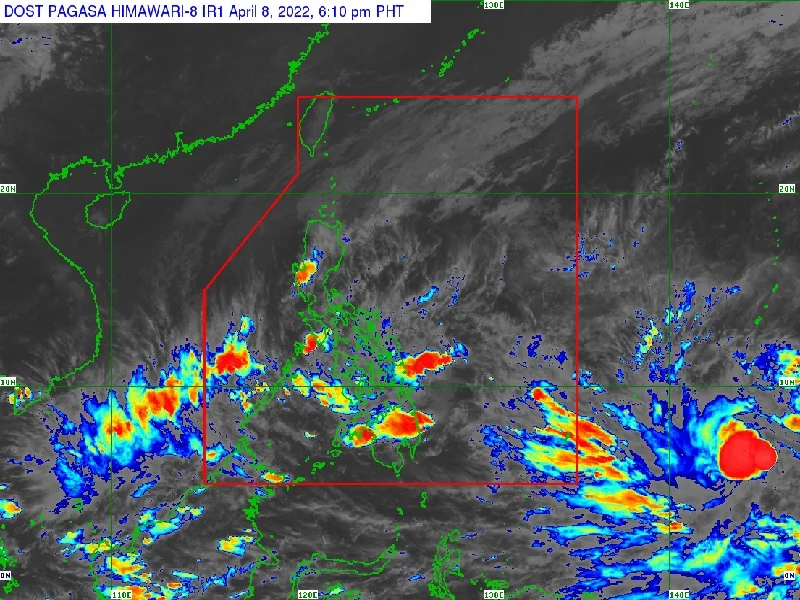
A tropical storm, spotted off Mindanao, could enter the Philippine area of responsibility (PAR) by either Monday or Tuesday, and possibly merge with the low pressure area (LPA) currently inside the country, the weather bureau said on Friday.
MANILA, Philippines — The tropical storm with international name “Malakas”—as contributed by the Philippines to the World Meteorological Organization—was spotted at 2,215 kilometers east of Mindanao as of 3 p.m. on Friday, based on the available data by the Philippine Atmospheric, Geophysical and Astronomical Services Administration (Pagasa).
According to Pagasa, the weather disturbance is packing 75 km per hour of maximum sustained winds and gustiness of up to 90 kph.
It is moving north-northwestward at 10 kph, the government’s weather bureau added.
Pagasa weather specialist Raymond Ordinario said Malakas has a possibility of absorbing the LPA, therefore moving in a northeast direction based on their forecast.
He said the merging of two weather systems, predicted to move in a northeast direction, would “spare” the areas affected currently by the LPA including the Bicol region, Mimaropa (Mindoro, Marinduque, Romblon, Palawan), and Quezon province.
Article continues after this advertisementOrdinario added that there was a slim chance for Malakas, once it enters PAR, to make landfall, citing Pagasa’s data.
Article continues after this advertisementAs of 3 p.m. on Friday, the LPA was estimated to be 185 km east-northeast of Surigao City in Surigao del Norte, embedded along the Intertropical Convergence Zone affecting the Visayas and Mindanao.
Ordinario said the tropical storm had already slowed down and would possibly enter PAR on either Monday or Tuesday, at the start of the Holy Week.
Should Malakas enter PAR, it would be the first tropical storm to enter the country this year and will be given the local name “Agaton,” the first on Pagasa’s list of names for weather systems entering the territory.