Monsoon rain to persist over Zambales, Bataan; NCR likely to have better weather on Friday
Pagasa weather satellite image
MANILA, Philippines — The southwest monsoon, locally known as “habagat,” will continue to bring rain over Zambales and Bataan and make northern Luzon skies cloudy, the state weather bureau said Thursday.
This while the Philippine Atmospheric, Geophysical and Astronomical Services Administration (Pagasa) predicted fair weather for the rest of Luzon, including Metro Manila, starting Friday, August 6.
But for Thursday night, Pagasa weather specialist Ana Cluaren said light to moderate to at times heavy rain may still occur in Pangasinan and La Union apart from Zambales and Bataan. She likewise said occasional rain and thunderstorms were likely in Metro Manila, Cordillera Administrative Region, remaining parts of Ilocos Region and Central Luzon, Babuyan Islands, Batanes, Rizal, Cavite, Batangas, and Occidental Mindoro during the same period.
The entire Visayas and Mindanao, on the other hand, will continue to experience hot and humid weather although short scattered rain remains possible by Friday afternoon and night.
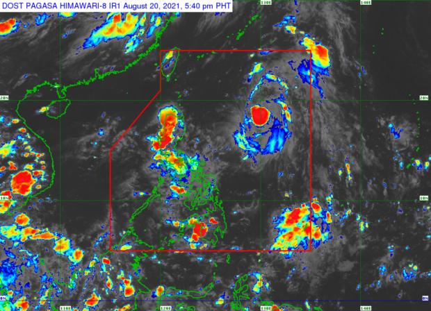
Clauren likewise said Pagasa is monitoring four weather disturbances within and outside the Philippine Area of Responsibility (PAR), but these storms are not expected to have a direct effect on the country.
Article continues after this advertisementAccording to the Pagasa weather specialist, a tropical storm with an international name Lupit was located 575 kilometers (km) west-northwest of Itbayat, Batanes, while another one with an international name Mirinae (formerly Gorio) was spotted 975 km northeast of extreme northern Luzon.
Article continues after this advertisementA tropical depression was also seen outside PAR at 1,900 km northeast of extreme northern Luzon while Severe Tropical Storm Nida was monitored some 2,925 lm east of txtreme northern Luzon.
“At hindi rin natin inaasahan na papasok ito sa ating area of responsibility,” said Clauren.
(Nor do we expect it to enter our area of responsibility.)
The forecast temperature range in key cities/areas for Friday, August 6, are as follows:
- Metro Manila: 28 to 32 degrees Celsius
- Baguio City: 17 to 20 degrees Celsius
- Laoag City: 27 to 31 degrees Celsius
- Tuguegarao: 26 to 37 degrees Celsius
- Legazpi City: 27 to 34 degrees Celsius
- Puerto Princesa City: 25 to 32 degrees Celsius
- Tagaytay: 23 to 29 degrees Celsius
- Kalayaan Islands: 27 to 32 degrees Celsius
- Iloilo City: 26 to 33 degrees Celsius
- Cebu: 27 to 34 degrees Celsius
- Tacloban City: 26 to 34 degrees Celsius
- Cagayan De Oro City: 23 to 34 degrees Celsius
- Zamboanga City: 25 to 35 degrees Celsius
- Davao City: 26 to 33 degrees Celsius
Pagasa further said a gale warning has been raised over the coasts of Batanes, Babuyan Islands, Ilocos Norte, Ilocos Sur, La Union, Pangasinan, Zambales, Bataan, Metro Manila, Cavite, Western coast of Batangas, Occidental Mindoro (including Lubang Island), and Palawan (including Kalayaan islands).
“Hindi natin pinapayagang pumalaot diyan ‘yung ating mga kababayang mangingisda pati na rin yung may mga maliliit na sasakyang pandagat,” said Pagasa weather specialist Ana Clauren.
(We will not allow fishermen as well as those with small vessels to sail in these areas.)
Ocean waves are expected to reach 2.8 to 4.5 meters tall in these areas, Pagasa noted.