Rain likely in Metro Manila, other parts of Luzon on Thursday – Pagasa
MANILA, Philippines — Moderate to heavy rains may be expected in Metro Manila and other parts of Luzon tomorrow, August 8, the state weather bureau said, as Typhoon Hanna enhances the southwest monsoon (habagat) on the western side of the country.
In the 11 a.m. bulletin of the Philippine Atmospheric, Geophysical and Astronomical Services Administration (Pagasa) on Wednesday, it said that the following areas will be affected by moderate to heavy rains on Thursday: National Capital Region, Ilocos Region, Cordillera Administrative Region, Zambales, Bataan, Rizal, Cavite, Laguna, Batangas, Occidental Mindoro, Oriental Mindoro, and northern portions of Palawan including Calamian and Cuyo Islands.
READ: Pagasa: ‘Hanna’ now a typhoon; Rainy Wednesday in parts of Luzon, Visayas
Meanwhile, Pagasa said light to moderate with at times heavy rains may likely prevail over Western Visayas and the rest of Luzon also on Thursday.
Pagasa has advised residents in these areas, especially those identified to be susceptible to floods and landslides, to take precautionary measures, coordinate with local disaster risk reduction and management offices, and monitor weather updates.
Article continues after this advertisementThe southwest monsoon will also trigger occasional gusty conditions in the western sections of Luzon and Visayas, the state weather bureau noted.
Article continues after this advertisementThus, it said, fisherfolks and those with small sea crafts are urged not to sail especially in areas under Tropical Cyclone Warning Signal Number 1, the seaboards of Luzon and Visayas, and the northern and eastern seaboards of Mindanao due to potentially rough conditions.
Pagasa said Hanna may possibly exit the Philippine Area of Responsibility (PAR) on Friday even as it remains less likely to hit land on any part of the country.
The southwest monsoon is also expected to shift northward as Hanna moves north-northwest, Pagasa added.
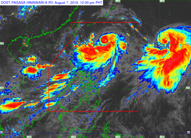
As of 10 a.m., Pagasa said, Hanna was last spotted 630 kilometers East of Basco, Batanes.
A low-pressure area (LPA) was likewise monitored west of Northern Luzon at 325 kilometers West of Dagupan City, Pangasinan. This LPA, Pagasa said, will most probably not develop into a tropical depression within the next 24 hours.
READ: New LPA spotted as ‘Hanna’ further intensifies – Pagasa
Further, Pagasa said that it spotted severe Tropical Storm Krosa some 2,055 kilometers east of extreme Northern Luzon.
It said Krosa packs maximum sustained winds of 95 kilometers per hour (kph) near the center and gustiness of up to 115 kph. It added that Krosa is moving north-northwest at 15 kph, and is not expected to enter PAR. /kga