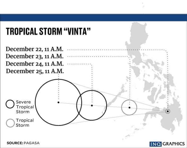
‘Vinta’ re-intensifies into severe tropical storm before Palawan landfall
“Vinta” continued to pose a threat as it re-intensified into a severe tropical storm on Saturday afternoon, ahead of its expected landfall in southern Palawan, the state weather bureau said.
“Scattered to widespread moderate to heavy rains will prevail over Palawan, while scattered light to moderate with at times heavy rains is expected over Visayas, Mindanao, and the rest of Mimaropa within 24 hours,” the Philippine Atmospheric, Geophysical and Astronomical Services Administration (Pagasa) said.
Reports said that deaths from Vinta reached over a hundred as of Saturday afternoon.
At its peak on Thursday evening, Vinta was a severe tropical storm but later weakened into a tropical depression by Friday afternoon.
Vinta grew stronger at sea, now with maximum sustained winds of 90 kilometers per hour near the center and gusts of up to 115 kph. It moved westward at 22 kph.
Signal No. 2 remained hoisted over southern Palawan, where Vinta was forecast to make landfall by Saturday evening.
Article continues after this advertisementThe rest of Palawan remained under Signal No. 1.
Article continues after this advertisementPagasa warned of dangerous sea travel over Palawan, southern seaboard of Mindoro provinces and the western seaboard of Aklan and Antique.
Vinta is seen to leave the Philippine area of responsibility by Sunday.
