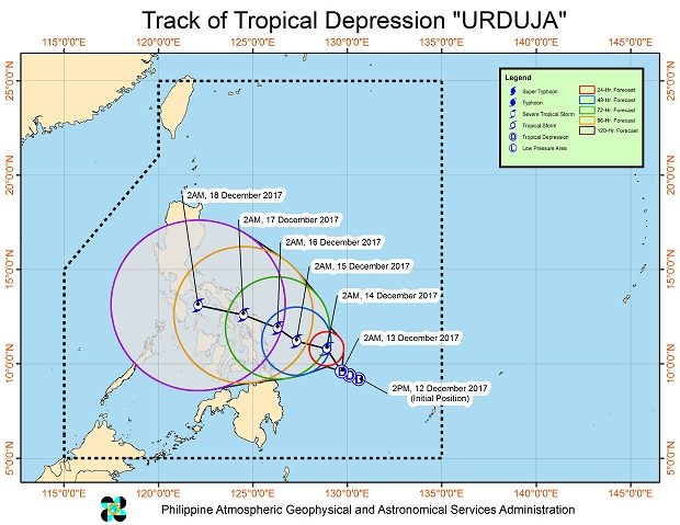

Tropical Depression “Urduja” continued to move closer to the Bicol region early Wednesday, the state weather bureau said.
While there was no storm signal raised at posting time, Bicol, Mindanao, Mimaropa and Calabarzon were expected to have cloudy skies with scattered to widespread rain and thunderstorms, the Philippine Atmospheric, Geophysical and Astronomical Services Administration said.
Weather specialist Chris Perez said the tropical depression could make landfall over Bicol or Eastern Visayas by Saturday.
As of 3 a.m., Wednesday, Urduja was packing maximum sustained winds of 55 kilometers per hour and gusts of up of 65 kph. It was moving west northwest at 6 kph, and was last spotted 455 kilometers east of Surigao City, Surigao del Norte.
It is expected to intensify into a tropical storm within 36 hours.
Metro Manila, the Cagayan Valley and the regions of the Cordillera and Central Luzon will continue to have cloudy skies with scattered rain due to the amihan or northeast monsoon.
Partly cloudy to cloudy skies with isolated light rains are expected over the Ilocos region. /cbb