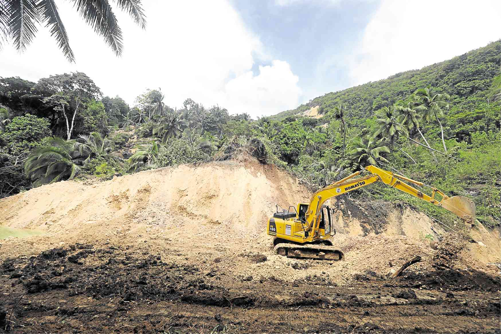
A backhoe clears soil and other debris that blocked a waterway in Boljoon town, Cebu province, following a landslide. —TONEE DESPOJO / CEBU DAILY NEWS
BOLJOON, Cebu — Landslides triggered by the movement of a fault line cutting across three subvillages in this southern town some 105 kilometers from Cebu City have forced at least 300 residents to flee their homes to ensure their safety, local officials said.
Worst hit was Sitio Calfranco in Barangay Lower Becerril where 17 families, or more than 200 people, fled, leaving the community deserted. Nineteen other families (100 people) left their homes in Sitio Sangi and Upper Cansiloy. Nine sitio compose Lower Becerril in Boljoon.
No one was hurt but a house was buried by soil in Upper Cansiloy, reports said.
Data from the Philippine Institute of Volcanology and Seismology (Phivolcs) showed that three fault lines cut across 17 areas in Cebu province. One is found in central Cebu, covering the cities of Cebu, Naga, Danao, Mandaue, Talisay and Toledo and the towns of Balamban and Compostela.
The nine other towns traversed by the fault lines are Oslob, Ginatilan, Boljoon, Alegria, Alcoy, Argao, Dalaguete, Minglanilla and Malabuyoc in southern Cebu.
Areas close to fault lines are prone to earthquakes and slight movements in the land, such as landslides and rockslides, Phivolcs said.
According to Eutemio Ternate, head of the Boljoon municipal disaster risk reduction and management office, Sitio Sangi is sitting on top of a fault line that has been moving, triggering the landslides. The fault line traverses Upper Cansiloy and Calfranco.
Ternate said the fault line remained “unstable.”
The movement of the fault line did not only result in landslides but was also changing the topography of the mountainous terrain of Lower Becerril.
Vehicles could not pass through the road that connected Lower Becerril to Barangay Upper Becerril because of cracks caused by the ground movement.
Socorro Medelda, Lower Becerril barangay councilor, said a crack about half a meter wide and 20 meters long was found on the 15-km Becerril-Nug-as Road following another fault movement on Monday morning.
Workers from the town government filled the crack with soil and covered the surface with limestone to allow motorcycles to pass.
“The earth we’re standing on continues to move. Every time the ground moves, we panic a bit,” Medelda said. “We felt like anytime our houses would be buried by eroding soil. We fear for our safety.”
“As you can see, the limestone we used to cover the makeshift road is soft and the ground below it is also soft. And we cannot ascertain if heavier vehicles can actually pass through it,” she added.
Boulders and uprooted trees had also blocked the flow of Lusopan River. The impounded water reached about 12.19 meters (40 feet) deep, Ternate said.
Only motorcycles can pass through this road in Barangay Lower Becerril in Boljoon, Cebu, after a landslide rendered it impassable to bigger vehicles. —TONEE DESPOJO / CEBU DAILY NEWS
He said that if the natural dam broke loose, water could easily wash away everything on its path.
“We were told that they had successfully decreased the water level by 3 meters. That’s a relief but the clearing operations there will be 24/7 until Lusapon River can finally flow back to the sea,” said Ruben Niere, Boljoon public information officer.
Niere said they were waiting for representatives from the Mines and Geosciences Bureau to help them assess the situation and decide if residents would be allowed to return to their homes.