Tropical Storm ‘Quedan’ enters PAR
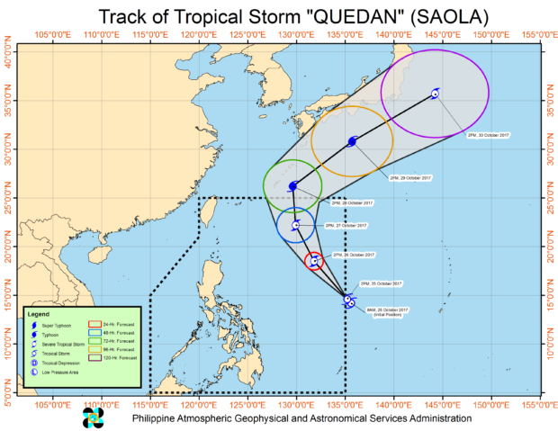
PAGASA’s map of Tropical Storm Quedan’s path.
Tropical Storm “Quedan” (international name: Saola) entered the Philippine area of responsibility on Wednesday afternoon, the state weather bureau said.
Quedan was last spotted 1,170 kilometers east of Virac, Catanduanes, with maximum sustained winds of 80 kilometers per hour and gusts of up to 95 kph, the Philippine Atmospheric Geophysical and Astronomical Services Administration said.
The storm also slowed down at a pace of 21 kph northwest.
The trough of Quedan will bring cloudy skies with scarred rains and thunderstorms over Visayas and Bicol region.
The intertropical convergence zone will bring cloudy skies with scattered rains and thunderstorms over Palawan and Mindanao.
Metro Manila and the rest of Luzon will have partly cloudy to cloudy skies with isolated light rains. /je