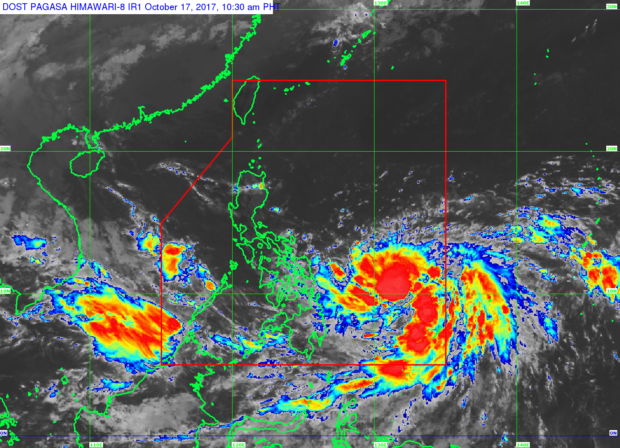
Tropical cyclone Paolo (international name Lan) has intensified into a severe tropical storm, as it continues to move across the Philippine Sea, the Philippine Atmospheric Geophysical and Astronomical Services Administration (Pagasa) said on Tuesday noon.
In its 11 a.m. severe weather bulletin, the weather bureau even predicted Paolo to strengthen into a typhoon in the next 24 to 36 hours but no tropical cyclone warning signal has been raised so far for any of the affected areas.
“The outer rainbands of Paolo may bring scattered light to moderate with possible occasional heavy rains over Bicol region, Visayas and Mindanao,” Pagasa also said.
The same weather bulletin showed that Paolo has a maximum sustained winds of up to 90 kilometers per hour (kph) and gustiness of up to 115 kph near the center, and is projected to move North-Northwest at 7 kph.
Paolo was last tracked 764 kilometers east of Guiuan, Eastern Samar. It is expected to dump moderate to heavy rainfall within its 450 kilometer-diameter.
Meanwhile, Pagasa said that a low pressure area was spotted 395 kilometers West of Coron, Palawan. It is anticipated to bring scattered light to moderate rains with possible occasional heavy rains over the province. /kga
