Pagasa: Wednesday will be less rainy as Kiko heads out of PAR
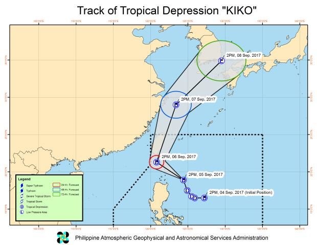
The track of Tropical Depression Kiko as of 5 p.m. on Tuesday, Sept. 5, 2017.
The entire country could expect less rain starting Wednesday afternoon as Tropical Depression Kiko, the first tropical cyclone for September and 11th for the year, was expected to exit the Philippine area of responsibility (PAR) by that time.
At the same, the effects of the southwest monsoon were expected to weaken further, according to the Philippine Atmospheric, Geophysical and Astronomical Services Administration (Pagasa).
In a press briefing at 5 p.m. on Tuesday, Pagasa forecaster Aldczar Aurelio said Kiko, which intensified only on Monday from a low pressure area, would probably exit PAR between Wednesday evening and early Thursday morning, as it picked up speed and headed north-northwest, traversing the seas, at 19 kilometers per hour (kph).
As of Tuesday afternoon, the center of Kiko was estimated to be still at sea at 270 kilometers east of Calayan, Cagayan, causing moderate to heavy rains, particularly in Northern Luzon, which is expected to last until Wednesday morning.
Estimated rainfall amount is from moderate to heavy within the 300-kilometer diameter of the tropical depression.
Article continues after this advertisementAs of Tuesday afternoon, Signal No. 1 was still hoisted over northern Cagayan, including the Babuyan Group of Islands and Batanes,as Kiko was expected to pass near extreme northern Luzon by late evening, particularly Batanes early morning on Wednesday.
Article continues after this advertisementResidents were warned against possible flashfloods and landslides due to the expected rains until Wednesday morning.
Small seacraft were advised not to head out to sea along the northern and eastern seaboard of northern Luzon and the eastern seaboard of central Luzon.
Kiko, which had maximum winds of up to 55 kph near the center and gustiness of up to 65 kph, was no longer expected to intensify, and would likely to exit PAR still as a tropical depression, or even weaken back into a low pressure area.
Meanwhile, light to moderate rains and thunderstorms would be affect Metro Manila, Central Luzon, Calabarzon, Bicol Region, Eastern Visayas, Caraga, and Northern Mindanao. /atm