Wet weekend ahead due to ‘Jolina,’ ‘habagat’
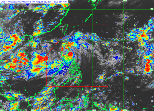
Expect a wet weekend as Tropical Storm “Jolina” (international name: “Pakhar”) and the southwest monsoon will continue to bring rains particularly over Luzon.
In a press conference at 5 p.m., the Philippine Atmospheric Geophysical and Astronomical Services Administration (Pagasa) said the center of “Jolina” was expected to make landfall in Aurora province in central Luzon by Friday night, and then cross northern Luzon, particularly Aurora, Quirino, Nueva Vizcaya, Ifugao, Benguet, Mountain Province, La Union and Ilocos Sur.
As of 4 p.m., the center of the storm was estimated 110 kilometers south-southeast of Casiguran, Aurora.
“Jolina” was already packing maximum sustained winds of 80 kilometers per hour near the center and gusts of up to 95 kph, as it continued moving west-northwest at 19 kph.
“Jolina” is expected to exit the landmass by Saturday morning and the Philippine area of responsibility by Sunday morning.
Article continues after this advertisementState weather forecaster Aldczar Aurelio said “Jolina” will mostly affect northern and central Luzon. Rains over the rest of Luzon, including Metro Manila, and western Visayas are still due to the southwest monsoon, Aurelio said.
As of Friday afternoon, 18 areas in Luzon have already been placed under a tropical cyclone warning signal due to “Jolina:” Signal No. 1 has been hoisted over Cagayan including the Babuyan Group of islands, Apayao, Ilocos Norte, Nueva Ecija, Pangasinan, northern Quezon including Polilio Island, and Camarines Norte; while Signal No. 2 was hoisted over Isabela, Aurora, Quirino, Kalinga, Mountain Province, Ifugao, Ilocos Sur, Benguet, Abra, La Union and Nueva Vizcaya.
