‘Isang’ to exit PAR Tuesday afternoon
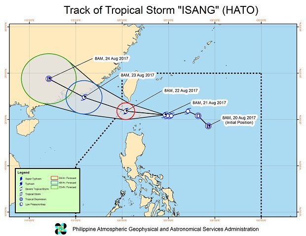
Tropical Storm “Isang” (Hato) is expected to exit the Philippine area of responsibility (PAR) on Tuesday afternoon, the state weather bureau said Monday afternoon.
The storm maintained its strength as it moved toward extreme Northern Luzon, the Philippine Atmospheric, Geophysical and Astronomical Services Administration said.
Isang is expected to be closest to Batanes on Tuesday morning before it leaves the PAR in the afternoon.
It will continue to enhance the southwest monsoon, which may bring light to moderate with possible occasional heavy rains over Metro Manila, Ilocos, Central Luzon, Calabarzon, Mimaropa, Bicol and Visayas, Pagasa said.
Isang packed maximum sustained winds of 80 kilometers per hour and gusts of up to 97 kilometer per hour. It moved west northwest at 15 kph.
Article continues after this advertisementThe storm was last monitored 170 kilometers east of Basco, Batanes.
Signal No. 2 remained hoisted over Batanes group of Islands, while Signal No. 1 was up at Babuyan group of Islands. JPV