‘Isang’ stronger by midday Monday
Tropical storm “Isang” further intensified midday Monday as it moved closer to extreme Northern Luzon.
The tropical cyclone now packed maximum sustained winds of 80 kilometers per hour near the center and gusts of up to 97 kph, the Philippine Atmospheric, Geophysical and Astronomical Services Administration (Pagasa) said,
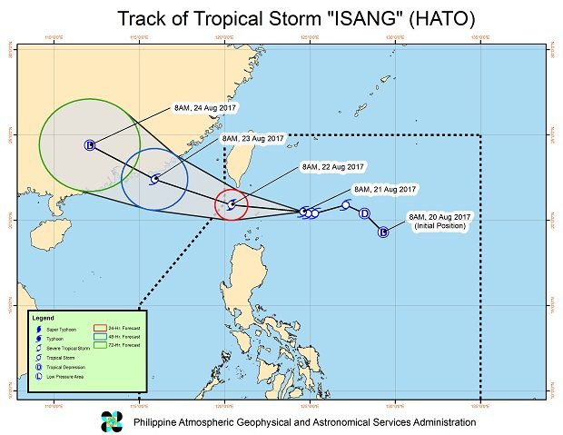
Isang was last spotted 275 kilometers east of Basco, Batanes, heading west northwest with a speed of 17 kph.
Signal No. 2 remained hoisted over the Batanes Group of Islands, while Signal No. 1 was raised over the Babuyan Group of Islands.
Isang will enhance the southwest monsoon which may bring light to moderate with possible occasionally heavy rain over Metro Manila, Central Luzon, Calabarzon, Mimaropa, Bicol and the Visayas.
Article continues after this advertisementModerate to occasionally heavy rain is expected within the 300 kilometer diameter of the storm.
Isang will be closest to Batanes by Monday night or early Tuesday, Pagasa said. CBB