Signal No. 2 over Batanes as ‘Isang’ nears
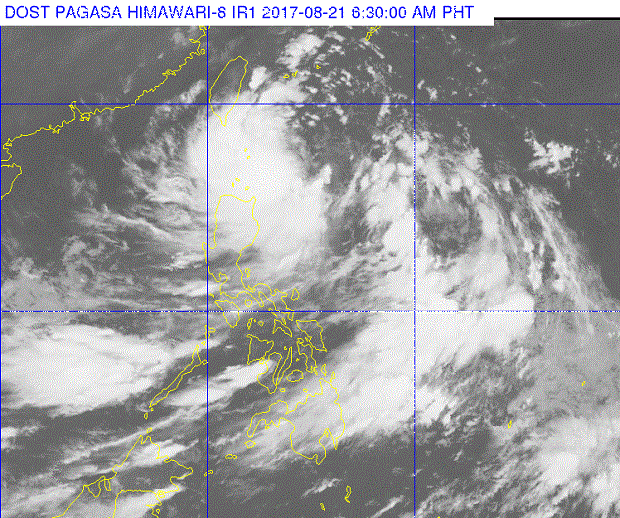
This satellite photo released by Pagasa Monday morning, August 21, 2017, shows tropical depression ‘Isang’ swirling near the Batanes. PAGASA IMAGE
Signal No. 2 was raised over Batanes as Tropical Storm “Isang” (Hato) maintained its strength early Monday, the state weather bureau said.
The storm packed maximum sustained winds of 65 kilometers per hour near the center and gusts of up to 80 kph, the Philippine Atmospheric, Geophysical and Astronomical Services Administration (Pagasa) said.
Signal No. 1 was raised over the Babuyan Group of Islands.
Isang was last tracked at 330 kilometers east of Basco, Batanes, at a speed of 17 kph west northwest.
Moderate to occasionally heavy rain is expected within the 300-kilometer diameter of the storm.
Article continues after this advertisementIsang will enhance the southwest monsoon which may bring light to moderate with possible occasionally heavy rain over Metro Manila, Central Luzon, Calabarzon, Mimaropa, Bicol, and the Visayas.
Article continues after this advertisementThe storm will be closest to Batanes on Tuesday morning and the chance of a landfall in Basco is possible, Pagasa said.
If it continues its track, Isang will exit the Philippine area of responsibility by early Wednesday, Pagasa added. CBB