Pagasa: More rains over parts of Luzon; improved weather elsewhere
Two weather systems are expected to enhance the southwest monsoon as of Saturday afternoon, which will bring moderate to occasionally heavy rains over the western section of Northern and Central Luzon.
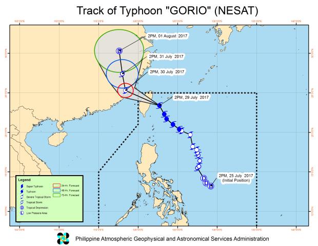
The rest of the country, including Metro Manila, however, will experience improved weather as Typhoon Gorio, internationally known as Nesat, slightly accelerated on Saturday afternoon, according to a bulletin issued at 5 p.m. by the Philippine Atmospheric, Geophysical and Astronomical Services Administration (Pagasa)
As of 4 p.m., the eye of the typhoon was located at 360 km north of Basco, Batanes. It was packing maximum sustained winds of 145 kph near the center, with a gustiness reaching up to 180 kph.
Though still within the Philippine area of responsibility (PAR), Gorio, moving northwest at 19 kph was expected to make landfall in Taiwan sometime between 6 p.m. and 7 p.m. It is expected to exit PAR by Sunday morning.
Signal No. 1 remained hoisted, however, over the Batanes Group of Islands.
Meanwhile, a tropical depression west of Northern Luzon has intensified into tropical storm, internationally knownas Haitang, according to Pagasa.
It was located 370 km west of Laoag City in Ilocos Norte. It has maximum sustained winds of 65 kph near the center, with a gustiness reaching up to 80 kph. It was forecast to be moving at 20 kph.
As of this posting, Haitang was still outside PAR, but along with Gorio, it was expected to enhance the southwest monsoon.
Haitang, which will known locally as Juaning once it enters PAR, was expected to enter the northwestern boundary of PAR sometime on Sunday afternoon or evening.
Sea travel would be risky over the seaboards of Northern Luzon and the western seaboard of Central and Southern Luzon. /atm
