Tourists advised: Consider leaving early due to ‘Crising’
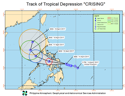
Forecast track of tropical depression Crising. IMAGE FROM PAGASA
Tourists in Visayas and southern Luzon may have to cut their vacations short as Tropical Depression “Crising” threatens to bring rains and choppy seas over the next three days in these areas.
In a briefing on Saturday morning, the Philippine Atmospheric, Geophysical and Astronomical Services Administration (Pagasa) said “Crising” was expected to make landfall over Samar Island at 3 to 5 p.m. in the afternoon, and traverse northern Visayas and portions of southern Luzon until Sunday evening. The weather disturbance is expected to have moved on to the West Philippine Sea by Monday, and the open sea on Tuesday.
READ: TD ‘Crising’ weakens; 17 areas under Signal No. 1
As of 11 a.m., Storm signal No. 1 has already been hoisted over Sorsogon, Burias island, Romblon, Masbate including Ticao island, Aklan, Antique, Iloilo, Capiz, Northern Cebu, Northern Negros Occidental, Northern Samar, Eastern Samar, Samar, Biliran, Leyte and Southern Leyte.
Storm signal No. 1 is also expected to be declared Saturday afternoon over Mindoro and the Calamian Group of Islands including popular tourist destination Coron, Palawan.
Pagasa weather forecaster Aldczar Aurelio said moderate to heavy rains are expected today until Tuesday particularly in Leyte, northern Cebu, Negros Occidental, Romblon, and Mindoro, and moderate to rough seas over seaboards of Samar, Leyte, and Sorsogon.
“Crising” has already weakened, now just packing winds of up to 45 kilometers per hour (kph) near the center and gustiness of up to 55 kph, and may possibly still weaken into a low pressure area after landfall. Aurelio noted the weather disturbance moves “fast,” at 20 kph.
But Pagasa weather division chief Esperanza Cayanan advised areas with storm signals to still be alert for possible flooding and landslides to be caused by heavy rains. Cayanan said Pagasa cannot assure the rains will weaken as “Crising” will still pass over seas and continue taking in vapor.
Even if the winds are not that strong, for those in the coastal areas in places to be affected by “Crising,” Cayanan warned: “It is dangerous for our countrymen in the beaches, especially those on small vessels, such as banana boats. Be alert that the waves may get higher.”
Cayanan also advised tourists to readjust their travel plans or even leave early as boat trips may get cancelled due to “Crising.”
“This information is to give them an idea if they need to stay in the area or leave early now because of the projected track…Although it’s not a strong storm, they need to plan in those areas where we will hoist signal No. 1 as they may have cancelled boat trips…Even if it weakens into an LPA, a gale warning will be issued anyway in areas where seas will be rough,” Cayanan said.
“We know you’re on a holiday mood. Maybe it’s not raining in those areas yet. But be aware of what we’re expecting,” Cayanan said.