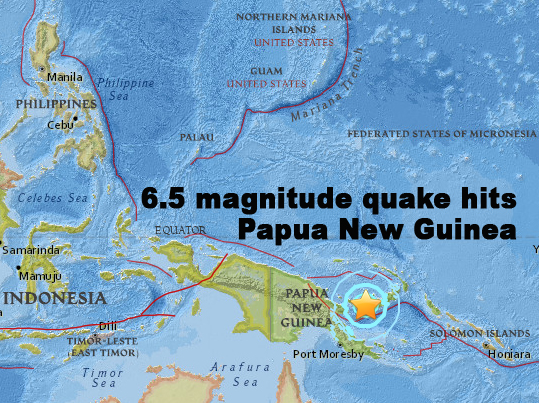
The map from the website of the United States Geological Survey shows the epicenter of the magnitude 6.5 earthquake that struck Papua New Guinea on March 5, 2017. USGS MAP
SYDNEY, Australia — A 6.5-magnitude earthquake struck off Papua New Guinea on Monday, officials said, but no Pacific-wide tsunami warning was issued.
The tremor hit at a depth of 28 kilometres (17 miles) near sparsely populated New Britain island, 450 kilometres northeast of the capital Port Moresby, the United States Geological Survey said.
The Hawaii-based Pacific Tsunami Warning Center ruled out a widespread tsunami.
“Based on all available data, a destructive Pacific-wide tsunami is not expected,” it said.
New Britain, the largest island of the Bismarck Archipelago, is east of mainland New Guinea and has a population of around 500,000 people.
It lies on the 4,000-kilometre Pacific-Australia plate, which forms part of the “Ring of Fire”, a hotspot for seismic activity due to friction between tectonic plates. CBB