‘Bising,’ ‘amihan’ to bring rains over weekend

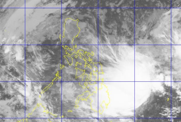
Satellite image of Tropical Depression Bising from Himawari 8 IR1 as of midnight of Feb. 4, 2017 (Image from PAGASA)
The second tropical cyclone for this year is here. A low pressure area east of Mindanao has developed into Tropical Depression “Bising.”
As of 5 p.m., the Philippine Atmospheric, Geophysical and Astronomical Services Administration (Pagasa) located the center of Bising at 735 kilometers east of Hinatuan, Surigao del Sur province, packing maximum winds of up to 45 kilometers per hour near the center, and gustiness of up to 55 kph.
Estimated rainfall amount is moderate to occasionally heavy within the 300-km diameter of the tropical depression.
With the effects of Bising in southern Philippines, and the northeast monsoon continuing to affect Luzon, cloudy skies with light to moderate rains and isolated thunderstorms are expected over Mindanao, the Bicol region, eastern and central Visayas, and the provinces of Quezon and Aurora.
Cloudy skies with light rains are also expected over Cagayan Valley, Metro Manila, the Ilocos and Cordillera regions, and the rest of Central Luzon.
Article continues after this advertisementBising is forecast to be 460 km east of Hinatuan today.