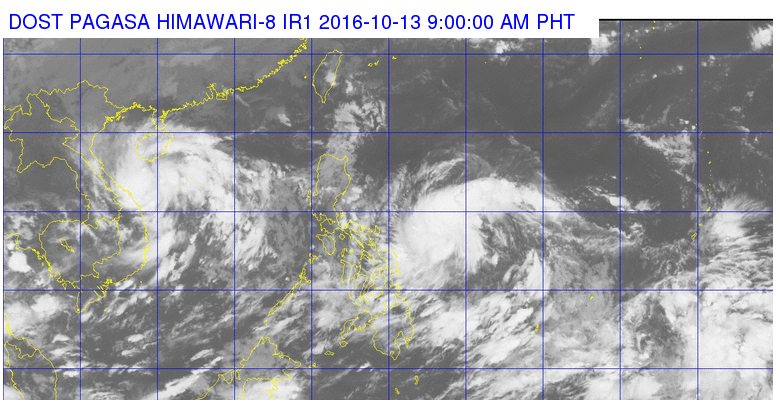
This satellite image from Pagasa shows the location of Tropical Depression Karen as of 9 a.m. Thursday.
A low pressure area developed into tropical depression “Karen” on Thursday, the state weather bureau said.
In its morning advisory, the Philippine Atmospheric, Geophysical and Astronomical Services Administration (Pagasa) said Karen was spotted 640 kilometers east of Catarman, Northern Samar as of 4 a.m. It packed maximum sustained winds of up to 45 kilometers per hour (kph) and gustiness of up to 55 kph.
Pagasa said the weather disturbance was expected to move west northwest at 11 kph.
Moderate to strong winds will prevail over northern Luzon, while coastal waters in eastern Luzon and Visayas will be moderate to rough.
Pagasa also said that light to moderate rains are affecting portions of Metro Manila, Cebu, Bohol, Leyte, Rizal, Cavite, Batangas, Bulacan, Camarines Norte, Northern Samar, Sorsogon, Quezon and Laguna. The showers may prevail until 12 noon Thursday. IDL
RELATED STORIES
LPA to develop into tropical depression ‘Karen’ on Thursday
LPA expected to turn into tropical depression