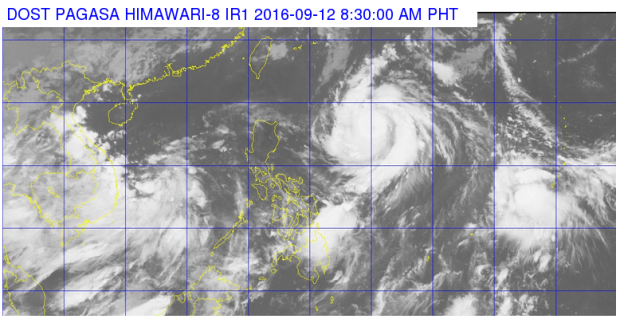
Signal No. 1 was raised over Batanes and Babuyan Group of Islands early Monday as Typhoon “Ferdie” (international name: Meranti) intensified further while maintaining its west-northwest direction.
The typhoon packed maximum sustained winds of 165 kilometers per hour near the center and gusts of up to 200 kph, the Philippine Atmospheric, Geophysical and Astronomical Services Administration (Pagasa) said.
Ferdie, which was last tracked 1,015 kilometers east of Tuguegarao City in Cagayan, moved with a speed of west northwest at 22 kph.
Moderate to heavy rains are expected within the typhoon’s 300-kilometer diameter.
By Tuesday morning, Ferdie is expected to be 550 kilometers east northeast of Aparri, Cagayan; 35 kilometers northwest of Itbayat, Batanes by Wednesday morning; 600 kilometers northwest of Itbayat, Batanes or outside the Philippine area of responsibility; and 945 kilometers north northwest of Itbayat Batanes by Friday morning.
Cloudy skies with light to moderate rains and thunderstorms is expected over Mindanao, Visayas, Bicol region and the province of Palawan, Pagasa said. IDL
RELATED STORIES
Rains to persist over PH as typhoon ‘Ferdie’ enters PAR
Tropical storm to enter PAR, to be named ‘Ferdie’
