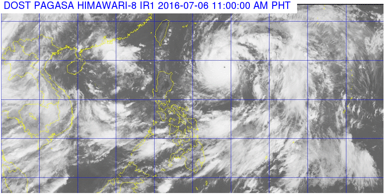
This satellite image from Pagasa shows the current location of Typhoon Butchoy as of 11 a.m. of July 6, 2016.
Signal No. 1 was raised in Batanes Group of Islands as Typhoon “Butchoy” (international name: Nepartak) maintained its speed and direction midday Wednesday.
The typhoon slightly intensified, with maximum sustained winds of 195 kilometers per hour near the center and gusts of up to 230 kph, the Philippine Atmospheric, Geophysical and Astronomical Services Administration said at 11 a.m.
READ: Butchoy intensifies; to boost habagat in south Luzon, Visayas
It continued to move northwest at 30 kph, and was last tracked 860 kilometers east of Calayan, Cagayan.
Moderate to heavy rains are forecast within the 550 kilometer-diameter of the typhoon.
Pagasa also warned fishermen to avoid the northern and eastern seaboards of Luzon.
Hawaii-based Joint Typhoon Warning Center (JWTC) has already upgraded Butchoy as a Super Typhoon, with international reports saying that it is this year’s strongest cyclone worldwide.
Pagasa and the JTWC, however, use different standards in measuring tropical cyclones.
Forecasters earlier predicted that Butchoy won’t make landfall, but will enhance the southwest monsoon.
READ: ‘Butchoy’ coming, not making landfall, but will linger
By Saturday morning, Butchoy is expected to be outside the Philippine area of responsibility. IDL