Safer Pinatubo route endorsed

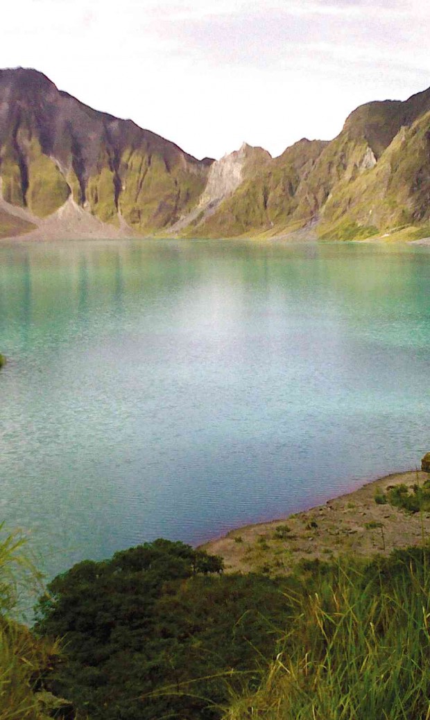
WHEN Mt. Pinatubo let out its strongest blast on June 15, 1991, and choked out the earth and mud in the earth’s bowels, this lake is what it left on the crater. The crater lake has since become a major tourist attraction in Central Luzon. TONETTE OREJAS/INQUIRER CENTRAL LUZON
CITY OF SAN FERNANDO—Citing public safety, the Pampanga provincial government has advised tourists and mountaineers to take the Mt. Pinatubo trail in Capas town in Tarlac instead of Porac town in Pampanga, when climbing the volcano’s crater lake.
Arwin Lingat, Pampanga tourism chief, issued the advisory following the rescue of 29 mountaineers in the highlands of Porac on Dec. 28.
He said the route in Barangay Sta. Juliana in Capas is considered the safest on dry months and treks there are regulated by the local government and monitored by the Philippine Air Force, which oversees the area.
The Capas government also bans swimming at the 3-km wide, 100-meter deep lake that formed at the caldera during the 1991 eruptions. The lake drains to a canal leading to a river toward Botolan town in Zambales province.
Another route
Article continues after this advertisementThe Sta. Juliana route, largely flat and slowly rising, uses the bed of the O’Donnel River that turns into a gray highway on dry months.
Article continues after this advertisementThe Philippine Institute of Volcanology and Seismology has warned against trekking on rainy months as rains move lahar and rocks that filled canyons as tall as 10-story buildings.
Lingat said the provincial government has not yet established a trail to the crater via Porac or built facilities to help tourists. Off-roaders and hikers take the Pasig-Potrero River route and negotiate a sharp climb via Barangay Sapang Uwak at the boundary of San Marcelino town in Zambales.
The Association of Tourism Officers has an agreement that Mt. Pinatubo treks should be referred to the Capas tourism office to ensure the safety of visitors, he said.
For precautions, he said, it is best that tourists register with the local police regardless of the route they take to the volcano.
Jerry Guiao, who provided transport services to the 29 climbers, said his clients belonged to the Ulupong Mountaineers and not with the Climber Philippines (Climbers League for Ideal Mountaineering and Balanced Environmental Responsiveness).
Not members
Ronald Magana, Climber president, said the hikers were not connected with his group. The mix-up might have happened because Climber relayed updates or shared information with other rescue groups coordinating the status of the Ulupong members.
Guiao said the hikers, aged 24 to 40 and half of them women, were divided into three groups. They were assigned three Aeta guides provided by village leaders in Pidpid, Inararo and Sapang Uwak.
The hikers declined to be interviewed.
Guiao said he dropped them off at the lahar watch point Delta 5 in Pidpid at 10 a.m. on Saturday. They walked at the side of the Pasig-Potrero River, reaching a camp where they stayed overnight.
“On Sunday, they began their ascent to the crater. But the slow trekkers reached the top at nightfall. They were late because, I was told, they were taking selfies, some of them sprained their feet and they lost their way,” Guiao said.
“Because of the delay, they did not make it to the Miyamit Falls at 5 p.m. So I went up and received distress signals via flashlights around 6:30 p.m. from the mountain. I signaled that I would fetch them but I can’t find them anymore,” he said.
Injured climbers
At a point where there was a mobile phone signal, Guiao received a text message from a friend of one of the climbers that there were injured hikers at the crater.
Guiao said he led rescue teams from the police and provincial and municipal disaster risk reduction and management councils.
There had been several incidents that led to loss of lives among tourists.
In January 2013, a visiting overseas Filipino worker, Roselito Julao, drowned at the crater lake. A landslide in August 2009 killed two French, a Belgian and two Filipinos while two hikers drowned in the Pasig-Potrero River as a typhoon battered the area in 2006.