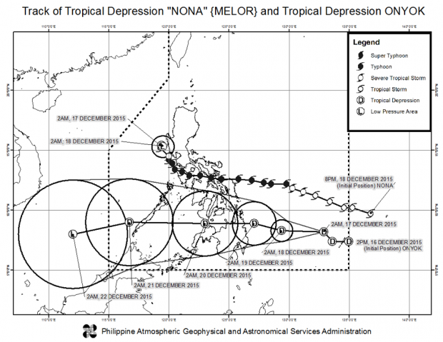
Weather disturbance Nona (Melor) has weakened to a tropical depression as it continued on its way out of the Philippines early Thursday, the state weather bureau said.
Only Zambales and Pangasinan were under Public Storm Warning Signal No. 1, the Philippine Atmospheric, Geophysical and Astronomical Services Administration (Pagasa) said.
Nona weakened to a tropical depression Wednesday night. By Friday, it is forecast to wane to a low pressure area as it exits the Philippine area of responsibility.
The tropical cyclone packed 55 kilometers per hour near the center and was last tracked 60 kilometers west of Iba, Zambales.
It was forecast to remain stationary.
Flashfloods and landslides are expected in low-lying and mountainous areas of Zambales, Aurora and the regions of Cagayan and Cordillera, Pagasa said.
Moderate to heavy rain is forecast within Nona’s 250 km diameter.
Tropical Depression Onyok, meanwhile, was last observed 700 km east of Mati City, Davao Oriental, with maximum sustained winds of 55 kph near the center. It is forecast to move west northwest at 15 kph.
The new tropical cyclone is expected to make landfall on Friday in Eastern Mindanao.
