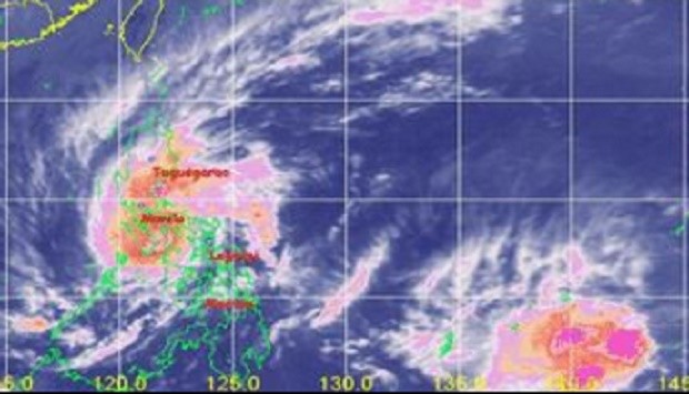
A hazy satellite photo from the Pagasa website shows a large low pressure area east of southeastern Mindanao, while typhoon ‘Nona’ covers much of Luzon. PAGASA WEBSITE
Typhoon “Nona” (international name Melor) made its fifth landfall in Pinamalayan, Oriental Mindoro, on Tuesday morning as the weather bureau spotted a new low pressure area (LPA) east of the country.
In a televised press briefing, weather forecaster Aldczar Aurelio of the Philippine Atmospheric, Geophysical and Astronomical Services Administration (Pagasa) said the typhoon hit land anew at 10:30 a.m.
Meanwhile, the new LPA was spotted 1,800 kilometers east southeast of Mindanao.
Nona packed maximum sustained winds of 140 kilometers per hour near the center and gusts of up to 170 kph.
Aurelio said the typhoon would weaken into a tropical storm and exit the Philippine area of responsibility on Friday as a low pressure area.
Nona moved westward at 15 kph and will bring rain within its 250 kilometer radius. It will exit the Philippine landmass on Tuesday afternoon.
Storm signals were raised in the following areas:
Signal No. 3
Calamian group of Islands, Oriental Mindoro and Occidental Mindoro including Lubang Island
Signal No. 2
Marinduque, Romblon and Batangas
Signal No. 1
Metro Manila, Bataan, Bulacan, Cavite, Laguna, Rizal, Quezon, Burias Island and Northern Palawan, including Cuyo Island
Flashfloods and landslides can be expected in the areas under Signals No. 2 and 3. Storm surges of up to 2 meters are also likely, Aurelio said.