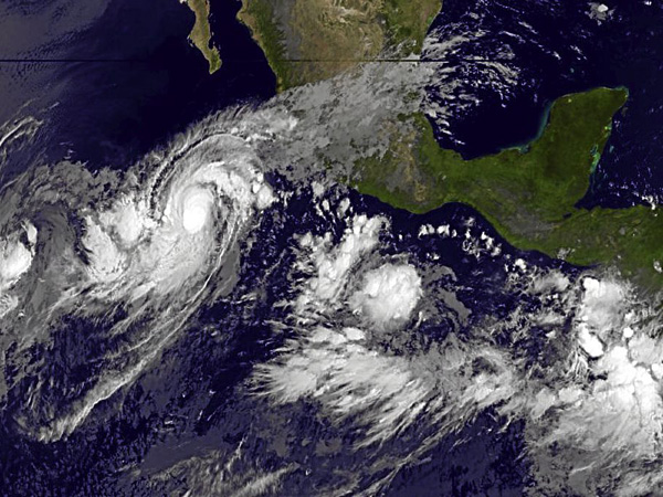
This October 9, 2011 handout image from NOAA's GOES Project Science, shows a satellite view of Hurricane Jova. US meteorologists said on Sunday that the category one hurricane was gathering strength as it headed for the southwestern Mexican coast and would likely grow further in the coming days. Jova was at 0900 GMT packing maximum sustained winds of up to 85 miles per hour (140 kilometers per hour), said the Miami-based National Hurricane Center. AFP
MIAMI—Forecasters say Hurricane Jova is gaining strength out in the eastern Pacific Ocean.
The U.S. National Hurricane Center in Miami said Sunday evening that Jova had maximum sustained winds of 90 mph (145 kph) and was centered about 305 miles (490 kilometers) southwest of Manzanillo, Mexico. It was moving east at 8 mph (13 kph).
Forecasters expect Jova could become a major hurricane by Monday night or Tuesday. A hurricane watch is out for Punta San Telmo north to Cabo Corrientes. A tropical storm watch south of there.
Meanwhile, Tropical Storm Irwin continued swirling in the eastern Pacific, about 810 miles (1304 kilometers) southwest of the southern tip of Baja California. Irwin had maximum sustained winds of about 50 mph (85 kph) but has prompted no coastal watches or warnings.