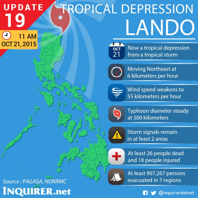
Tropical depression “Lando” (international name: Koppu) maintained its strength as it traversed Balintang Channel midday Wednesday.
Public storm warning Signal No. 1 remained hoisted over Batanes and Northern Cagayan including Babuyan Group of Islands, the Philippine Atmospheric, Geophysical and Astronomical Services Administration (Pagasa) said.
Occasional rains and gusty winds will be experienced over these provinces.
BACKSTORY: ‘Lando’ weakens further but heavy rain still expected
The National Disaster Risk Reduction and Management Council said that at least 26 people have died during the onslaught of Lando, which battered Northern and Central Luzon during its peak.
READ: NDRRMC: ‘Lando’ death toll rises to 26
Lando continued to move six kilometers northeast, with maximum winds of 55 kph. Moderate to heavy rains are seen within its 500-kilometer radius.
The tropical cyclone was last tracked 80 kilometers east northeast of Calayan, Cagayan. It will be outside the Philippine area of responsibility (PAR) by Monday morning.
Pagasa earlier said that Lando may be downgraded into a low pressure area before it exits PAR.
Fishermen were warned to avoid the seaboards of Northern and Central Luzon and the eastern seaboard of Southern Luzon. IDL
