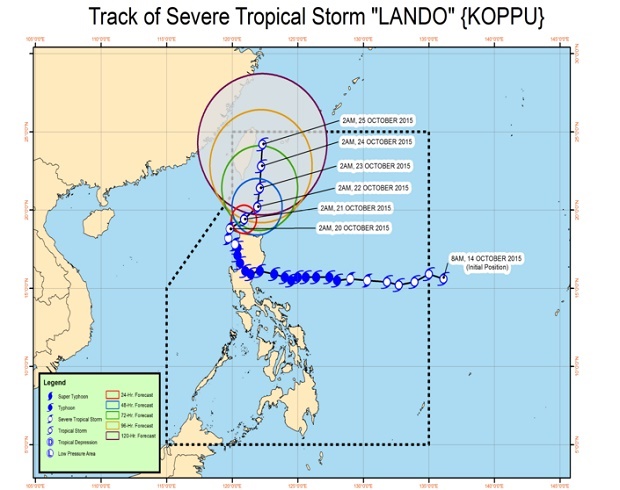
‘Lando’ skirting Luzon; heavy rain to continue
Eight areas remained under Public Storm Signal No. 2 as tropical storm “Lando” skirted the Luzon mainland off Ilocos Norte, the state weather bureau said Tuesday.
In its 4 a.m. bulletin, the Philippine Atmospheric, Geophysical and Astronomical Services Administration (Pagasa) said Lando was 130 kilometers northwest of Laoag City in Ilocos Norte.
The storm had maximum sustained winds of 95 kilometers per hour with gustiness of up to 120 kph.
The weather bureau said the tropical storm is moving slowly at 5kph northeast.
Signal No. 2 was raised over Ilocos Norte, Ilocos Sur, Apayao, Abra, Batanes, Northern Cagayan including Calayan and Babuyan group of Islands.
Article continues after this advertisementSignal No. 1 was hoisted over La Union, Pangasinan, Benguet, Nueva Vizcaya, Ifugao, Mt. Province, Kalinga, Isabela and the rest of Cagayan.
Heavy to intense rain is expected within the 600-kilometer radius of the storm, the bureau said.
Pagasa said Lando was expected to be 60 kilometers west southwest of Calayan, Cagayan by Wednesday morning. By Thursday morning, it is forecast to be at 115 kilometers north northeast of Basco, Batanes.
