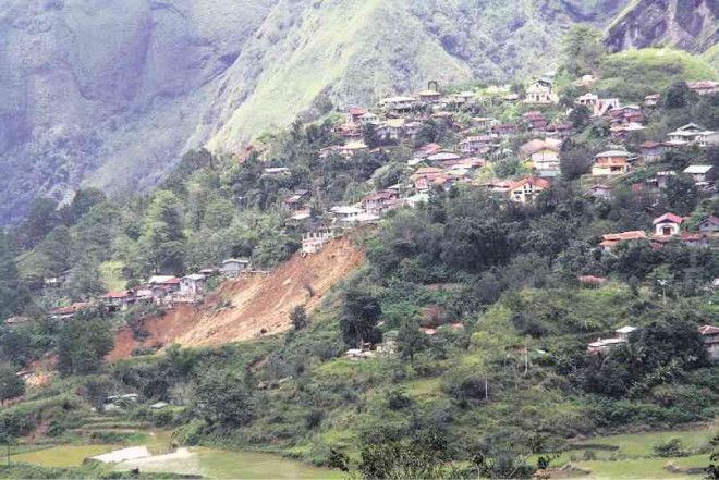
DANGER ZONE Typhoon “Ineng” revealed the limestone and mud-stone foundations of this section of Poblacion village in Bakun, Benguet province, which imperil some 20 households. PHOTO CONTRIBUTED BY MINES AND GEOSCIENCES BUREAU
BAGUIO CITY—Rain dumped by Typhoon “Ineng” (international name: Goni) revealed geological weaknesses that would force the relocation of two communities in the provinces of Benguet and Abra, government geologists said.
Heavy and continuous rain in August weakened a mountain slope in Sitio Buagi in Barangay Poblacion in Bakun, Benguet. Three houses were hit by a landslide there but nobody was hurt.
However, a 250-meter section of the Bakun slide threatened 20 households in the area, said Ronnie Fortes, a geologist of the Mines and Geosciences Bureau (MGB) in the Cordillera.
Rain dumped by the typhoon also weakened a mountain slope that hosts farms in Barangay Tamac in Villaviciosa, Abra, and future slides may dump rocks and mud over 150 households in that village, said Benigno Cesar Espejo, the region’s chief geologist.
The governments of Bakun and Villaviciosa should plan how they will build new relocation sites for residents of these villages, said Fay Apil, MGB Cordillera director.
Apil said MGB had established danger zones in other upland areas that were ignored by local officials or had prompted the government to transfer houses to other areas, without installing appropriate run-off water drains and adequate sanitation.
“Because these relocation sites cannot control where rainwater will drain out, they may soon encounter the same problems they tried to avoid when they left their original communities, such as potential landslides,” she said.
Ineng triggered landslides in the Cordillera provinces, including the mining town of Mankayan in Benguet, where rescue workers continue looking for two of 16 miners buried by an eroded mountainside. More than 20 people died from these landslides.
Apil said the eroded mountainside in Sitio Elizabeth in Barangay Taneg in Mankayan was unstable and might move again once heavy rain hit the area again.
“It is an uninhabited area but miners have frequented the site so [their activities] may have to stop. The expenses for keeping that mountain stable will be too high for an area with no settlers, so we will have to abide by nature’s course,” she said.
Lives were spared when the mountain ridges at Sitio Buagi in Bakun moved in August. But the area’s rock foundations were a combination of limestone (which is porous) and a rock bed of mud stones (a mixture of clay and silt-sized particles), Fortes said.
He said the MGB declared these sections of the mountain danger zones, but the impact of the weakened area had been felt in the nearby sections of Poblacion village.
For example, cracks have been seen on Virgin Mary Chapel in the village, which is 40 m from the landslide area, Fortes said.
Cracks have also been observed in a school building and the village’s water reservoir, he said.
The town has not yet identified a possible relocation site for the 20 families who live near the Bakun slide, he said.
In Villaviciosa, Espejo said, close to 200 families in Barangay Tamac are located “immediately down slope of [a] progressive landslide” and are exposed to future hazards there.
The initial erosion spanned 10 m but it can move once more if strong rain pours, he said. The mountain slopes are filled with farms, “thus rendering the soil to be always saturated [and consequently] reducing its cohesive strength,” he said.
Janet Armas, Cordillera director of the Department of Social Welfare and Development, has been informed that 167 families in Tamac may have to be relocated.