El Niño gaining strength, say Australian experts
INQUIRER FILE PHOTO
The El Niño weather phenomenon continues its buildup as conditions in the Pacific Ocean and in the atmosphere work together to raise water temperatures, according to Australian climate experts.
“The El Niño has continued to strengthen over the past two weeks,” the Australian Bureau of Meteorology (BoM) said in its latest fortnightly update.
“The ocean and atmosphere are reinforcing each other,” the BoM said, referring to sea surface temperatures “well above El Niño thresholds,” as well as weaker trade winds.
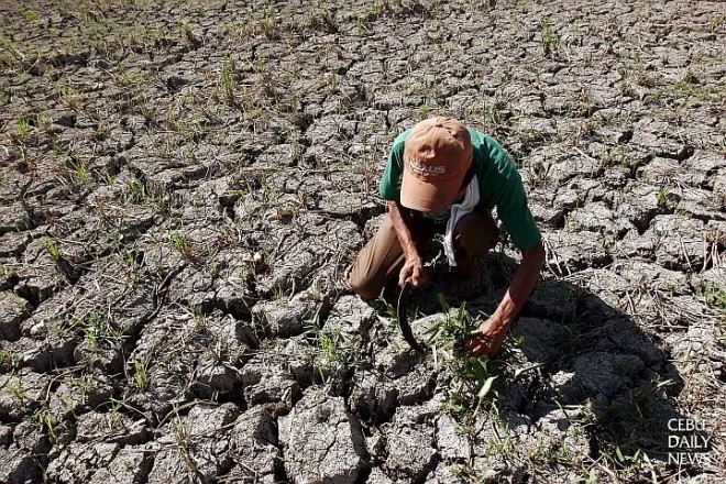
In the Philippines, Agriculture Assistant Secretary Edilberto de Luna said the Department of Agriculture had sought additional funding of P940 million from the Department of Budget and Management to help mitigate the impact of El Niño on rice-producing provinces.
De Luna, who is in charge of the government’s national rice program, told reporters that of the amount, P618 million would go to water management, P259 million to production support, P24 million to an information and communication campaign, and P17 million to program management.
Article continues after this advertisement“The additional support program will be given only to farmers and cooperatives who have expressed interest in continuing to plant despite the prevailing drought,” he said.
Article continues after this advertisementData from the Philippine Astronomical, Geophysical and Atmospheric Services Administration showed that farms in the Ilocos, Cagayan Valley, Central Luzon, Mimaropa and Bicol regions will bear the brunt of the El Niño.
Monitoring by the BoM for the week ending Aug. 16 showed the sea surface in the eastern equatorial Pacific Ocean as well as parts of the central Pacific registering 2 degrees Celsius above normal.
“The current El Niño has exceeded the 2006 peak of 1.2 degrees Celsius above normal, but current anomalies still remain well short of the 1982 and 1997 peaks at 2.8 degrees and 2.7 degrees Celsius above normal, respectively,” the Australian agency said.
In the same period, the BoM observed the direction of trade winds reversing to west of the International Date Line.
Also, cloudiness near the date line has exceeded average levels, another usual occurrence during El Niño.
The BoM said the “strong coupling” of the tropical Pacific Ocean and the atmosphere was typical of a “mature El Niño.”
Such firm link “suggests only a small chance of the event finishing before the end of the year,” the agency said.
The BoM said all eight international climate models it surveyed indicated the central Pacific Ocean would warm further in the coming months, and the equatorial central Pacific would show indicators above El Niño thresholds until at least the start of 2016.