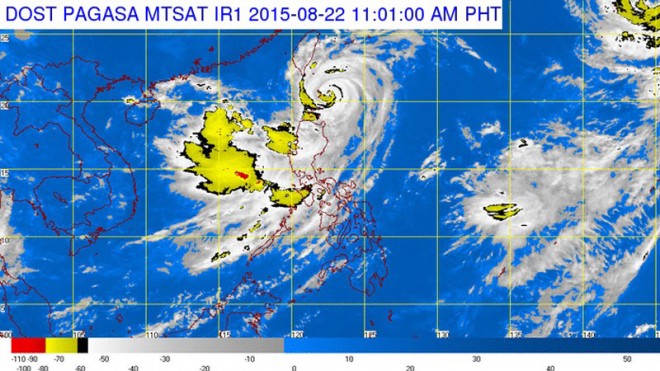
In its 11 a.m. weather bulletin, the state weather bureau said the eye of typhoon Ineng was located 165 kilometers northeast of Calayan, Cagayan or 70 km east of Basco, Batanes.
Ineng maintained its maximum sustained winds of 160 kilometers per hour near the center and gustiness of up to 195 kph.
From 9 kph, its speed went up to 11 kph as it moves north northeast.
It is expected to reach 295 km northeast of Basco, Batanes by Sunday morning and will be out of the Philippine Area of Responsibility by Tuesday.
Public storm warning Signal no. 3 remains up in Batanes, Calayan and Babuyan group of Islands while Signal no. 2 has been declared over Northern Cagayan, Apayao and Ilocos Norte.
Signal no. 1 is up in Isabela, the rest of Cagayan, Kalinga, Mt. Province, Abra, and Ilocos Sur.
The said provinces have been warned of possible flash floods and landslides. Storm surges of up to 2 meters high may hit coastal areas in provinces under Signal no. 3 and 2.
Pagasa said moderate to heavy rainfall is expected within the 500 km diameter of the typhoon.
Habagat or southwest monsoon enhanced by the effects of Ineng is expected to bring rains over Metro Manila and the rest of Luzon.
“Fisher folk are advised not to venture out over the seaboard of Pangasinan and La Union, seaboards of Central and Southern Luzon and the eastern seaboard of Visayas,” Pagasa said in its bulletin.
At least five people were killed in northern Luzon on Friday despite Ineng not making landfall. Kristine Angeli Sabillo/RAM
RELATED STORIES
Orange rainfall warning up in Cavite, Batangas, Laguna
Yellow rainfall warning raised in Metro Manila, nearby provinces