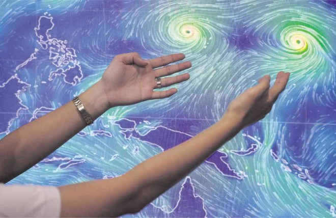
STORMS LIKE VAN GOGH’S STROKES The eyes of Typhoon “Ineng” and Typhoon “Atsani” are captured in a satellite image of the storms over the Pacific. Ineng is expected to enter the Philippine area of responsibility Tuesday afternoon and may hit the northern tip of Luzon by the weekend. The image of the typhoons is eerily similar to the stars painted by the Dutch artist Van Gogh in “The Starry Night.” GRIG C. MONTEGRANDE
Typhoon “Ineng” (international: name Goni) is expected to enter the Philippine area of responsibility (PAR) Tuesday afternoon and may make a direct hit on extreme northern Luzon by the weekend, the weather bureau said on Monday.
The country will feel Ineng’s effects beginning Wednesday, when the typhoon will bring monsoon rains over the Visayas, according to the Philippine Atmospheric, Geophysical and Astronomical Services Administration (Pagasa).
Luzon may experience monsoon rains on Thursday and Friday, Pagasa said.
Meteorologist Glaiza Esculiar said Ineng might make landfall in northern Luzon, which was battered by Typhoon “Hanna” (international name: Soudelor) two weeks ago.
“The possibility that it will make landfall in extreme northern Luzon is increasing, although there is still the slightly bigger chance it will not,” she said.
Should the typhoon hit land, this may be on Friday, she added.
Meanwhile, Ineng, the ninth cyclone to hit the country this year, continued to intensify as it neared the country.
As of Monday night, it was packing maximum sustained winds of 170 kilometers per hour (from 140 kph early Monday) with gusts of up to 205 kph (from 170 kph) as it barreled toward northern Luzon at 20 kph moving west northwest.
After the Philippines, the typhoon will head for Taiwan or southeastern China on the weekend, Pagasa said.