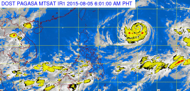
MT Satellite image August 5, 2015, 6:01 a.m. Screengrab from https://www.pagasa.dost.gov.ph/
Supertyphoon “Hanna” (International name: Soudelor) entered the Philippine area of responsibility on Wednesday morning.
As of 7a.m., Hanna was 1,420 kilometers east Calayan, Cagayan, the Philippine Atmospheric Geophysical and Astronomical Services Administration said.
Hanna packs maximum sustained winds of 215 kilometers per hour near the center and gusts of up to 250 kph.
READ: ‘Soudelor’ now a supertyphoon | Super Typhoon Soudelor to spare PH but will enhance ‘habagat’
It moved west northwest at 20 kph.
Mendoza said Soudelor will enhance the southwest monsoon in Mindanao and may also bring rain to parts of Luzon and Visayas in the coming days.
The cyclone will not make landfall, however, according to Pagasa, and is targeting Japan, Taiwan and China.
Monsoon rains, which may trigger flashfloods and landslides, will be experienced in Mindanao, Pagasa said.
Cloudy skies with light to moderate rains and isolated thunderstorms will be experienced over the Visayas and the province of Palawan while partly cloudy to cloudy skies with isolated thunderstorms will prevail over Metro Manila and the rest of Luzon. RA/IDL
Originally posted: 06:31 AM August 5th, 2015