Quake forms new, safer trail to Mt. Kinabalu

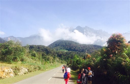
Tourists walk away from Mount Kinabalu hours after a magnitude 5.9 earthquake shook the area in Kundasang, Sabah, Malaysia, Friday, June 5, 2015. AP FILE PHOTO
KOTA KINABALU — The June 5 earthquake may have “given birth” to a new trail to reach the 4,095m Low’s Peak of Mount Kinabalu.
Sabah Minerals and Geo-science Department has suggested a new trail to Sabah Parks in view of rocks and boulders that had piled up along the old trail.
The rocks and boulders between Km6.1 and Km6.9 (between Gunting Lagadan Hut and Sayat Sayat hut) could be unsafe for climbing at the moment, according to the department’s chief Jontih Enggihon.
He believes that the unstable condition of the rock and boulder slides caused by the earthquake could slide further during the current aftershocks.
At the moment it was still not safe to climb up Mount Kinabalu and Sabah Parks was aware of the situation.
Enggihon said the 5.9 magnitude earthquake also caused cracks on the mountain’s slopes and his department would cooperate with Sabah Parks in constructing new safer trails.
Sabah Parks director Dr. Jamil Nais had on Saturday stated that Mount Kinabalu summit area was still intact but part of the western lobe of the Donkey’s Ear and portions of Tunku Abdul Rahman Peak were damaged.
After going up to the summit on Saturday to inspect the damage, Dr. Jamil said that climbing from Laban Rata to Sayat Sayat was still dangerous and he would not want anyone to go up that stretch for now.
Calling that part “river of rocks” where many of the 18 climbers were killed, he said there was plenty of loose rocks in the area.
He said the summit itself was not badly affected by the earthquake and aftershocks.
The 8.72km trail from Kinabalu Park base to Low’s Peak has been the track used by climbers daily.
RELATED STORIES
Magnitude 6.0 quake jolts Sabah—USGS