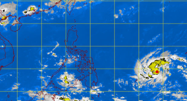
MT Satellite image May 5, 2015, 9:01 a.m. Screengrab from https://kidlat.pagasa.dost.gov.ph/index.php
A TROPICAL storm seen to enter the Philippine area of responsibility (PAR) on Thursday has moved closer to Mindanao on Tuesday.
“Noul” was last spotted 1,488 kilometers east of Surigao del Norte, the Philippine Atmospheric, Geophysical and Astronomical Services Administration (Pagasa) said.
As of 8 a.m., the storm moved slowly west at 6 kph, Shelly Ignacio, weather specialist of Pagasa said.
Ignacio said the storm, once it enters PAR, could move closer to the Northern Luzon landmass before it recurves and moves away from the country.
It will be locally named “Dodong” when it enters PAR.
Easterlies, or warm winds from the east, will affect the eastern section of Luzon and the Visayas on Tuesday.
“The whole country will experience partly cloudy to cloudy skies with isolated rains or thunderstorms,” Pagasa said. CB