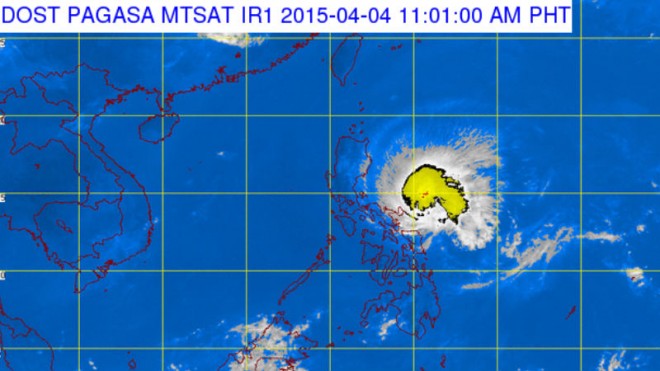
The state weather bureau said in its 11 a.m. report that “Chedeng” was moving west northwest at 22 kilometers per hour (kph), up from a speed of 19 kph earlier in the morning.
It was located 450 east southeast of Casiguran, Aurora as of 10 a.m., the Philippine Atmospheric, Geophysical and Astronomical Services Administration (Pagasa) said.
Chedeng’s maximum sustained winds remained at 130 kph near the center with gustiness of up to 160 kph.
During a broadcast press briefing, Pagasa said the effects of the typhoon may be felt as early as Saturday evening.
Signal 2 up in 10 provinces
More provinces were placed under public storm warning signal no. 2. The following areas should expect winds of around 61 to 100 kph in the next 24 hours: Isabela, Southern Cagayan, Kalinga, Mt. Province, Ifugao, Benguet, Nueva Vizcaya, Quirino, Aurora and Catanduanes.
Meanwhile, signal no. 1 remained up in the rest of Cagayan including Babuyan Island, Apayao, Ilocos Norte, Ilocos Sur, Abra, La Union, Pangasinan, Nueva Ecija, Tarlac, Pampanga, Bulacan, Rizal, Quezon, Camarines Norte and Camarines Sur.
Pagasa said it is possible that “Chedeng” will further weaken and become a tropical storm before it makes landfall on Sunday. Its maximum sustained winds may also decrease when it hits land.
Nevertheless, it warned that “Chedeng” remains a typhoon. Storm surges of up to two meters may be expected over the eastern coast of Aurora, Quezon and Isabela.
It is expected to reach the coast of Southern Isabela on Sunday morning and will immediately exit landmass via Ilocos Sur by Sunday afternoon. It should exit the Philippine area of responsibility by Monday morning. IDL
RELATED STORIES
Storm signals up in 24 provinces as Chedeng nears Isabela-Aurora
DSWD: 309k food packs readied in areas to be affected by ‘Chedeng’