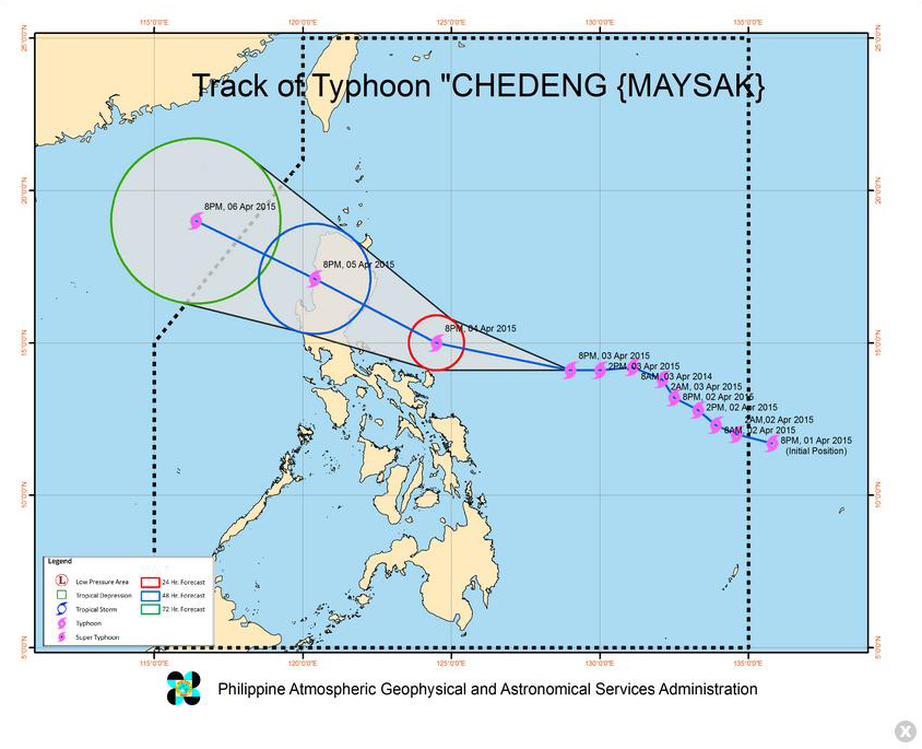
MANILA, Philippines–Typhoon “Chedeng” (international name: Maysak) has weakened further as it approaches the eastern seaboards of Luzon, the weather bureau said Friday evening.
In its 11 pm bulletin, the Philippine Atmospheric, Geophysical and Astronomical Services Administration said “Chedeng” packs maximum sustained winds of 130 kilometers per hour and gusts of up to 160 kph.
“Chedeng” clocked in maximum sustained winds of 150 kph and gusts 185 kph in Pagasa’s 5 pm bulletin.
Pagasa said that “Chedeng” was spotted at 730 kilometers east southeast of Casiguran, Aurora, at 10 pm while it moves at a pace of 19 kph going west northwest.
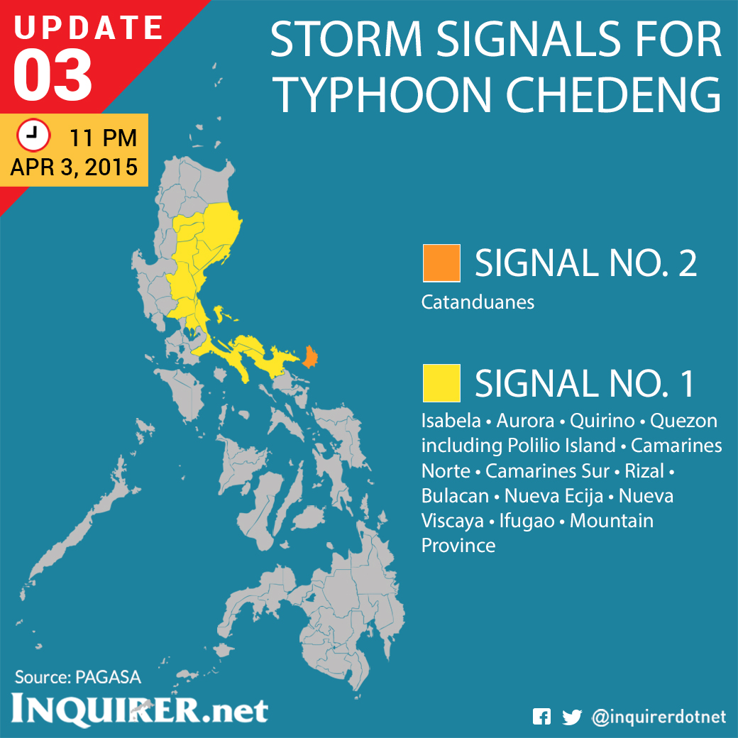
Public storm warning signal no. 2 is raised over Catanduanes.
Camarines Sur, Camarines Norte, Quezon including Polillo Island, Rizal, Bulacan, Nueva Ecija, Aurora, Quirino, Nueva Vizcaya, Ifugao, Isabela, Mountain Province are under signal no.1.
“Chedeng” is expected to make landfall over the coast of Isabela-Aurora area on Sunday morning and exit the Philippine landmass via Ilocos Sur on Sunday evening.
It is expected to leave the Philippine Area of Responsibility on Monday morning. TVJ

RELATED STORIES
Signal No. 1 up in Catanduanes, Camarines Sur due to ‘Chedeng’
‘Chedeng’ maintains strength as it nears Luzon