Signal No. 1 up in Catanduanes, Camarines Sur due to ‘Chedeng’
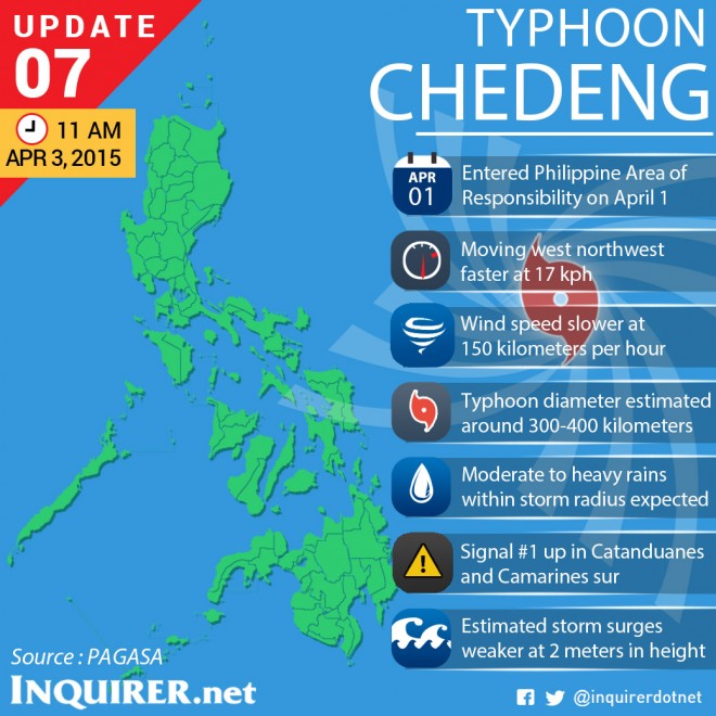
Signal No. 1 was raised in Catanduanes and Camarines Sur on midday Friday due to Typhoon Chedeng (international name: Maysak).
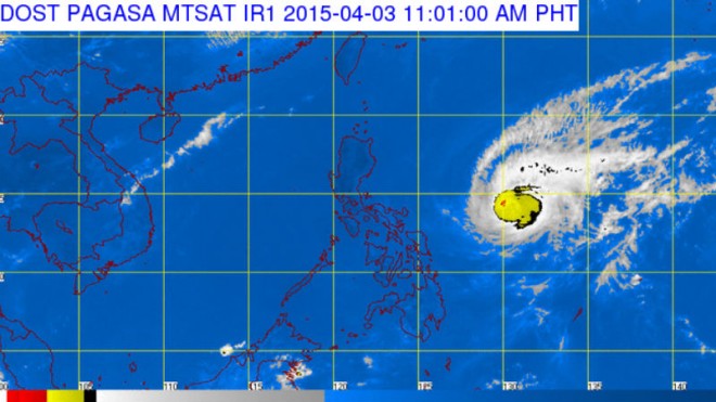
The typhoon weakened slightly as it moved toward the eastern coast of Central and Northern Luzon, the Philippine Atmospheric, Geophysical and Astronomical Services Administration said.
READ: ‘Chedeng’ to be felt by Friday–Pagasa
Chedeng packed maximum sustained winds of 150 kilometers per hour near the center and gusts of up to 185 kph. It moved west northwest at 17 kph.
The typhoon was last tracked 700 kilometers east northeast of Virac in Catanduanes or 950 kilometers east southeast of Casiguran, Aurora.
READ: Thousands of Baler travelers warned as ‘Chedeng’ nears
Chedeng is expected to make landfall over the coast of Aurora-Isabela by Sunday and exit Philippine landmass via Ilocos Sur on Sunday evening and the Philippine area of responsibility by Monday morning.
The areas under storm Signal No. 1 (winds of 30 to 60 kph in at least 36 hours) were alerted against possible flashfloods and landslides. Its impacts include:
- Twigs and branches of trees maybe broken
- Some banana plants may tilt or land flat on the ground
- Rice in flowering stage may suffer significant damage
- Some nipa and cogon houses may be partially unroofed
- Sea travel of small sea crafts and fishing boats is risky
Storm surges of up two meters are possible over the eastern coast of Aurora, Quezon and Isabela. Pagasa warned, and asked the public to refrain from outdoor activities particularly along the beaches of the eastern section of Luzon starting Saturday. IDL
RELATED STORIES

